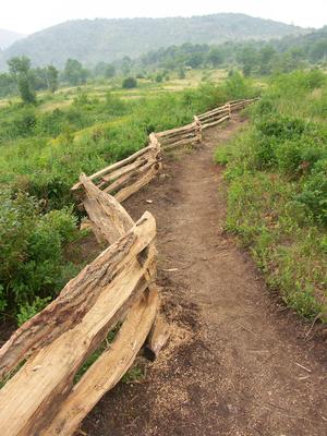
The lower end of this trail is brand-new; winds slowly up the dry slope below the airstrip on a moderate grade. The rest of this trail follows the old airstrip itself with a nice view. That part is not recommended, though on a hot, sunny day!
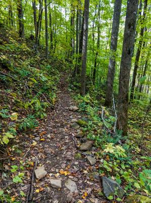
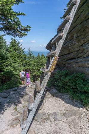
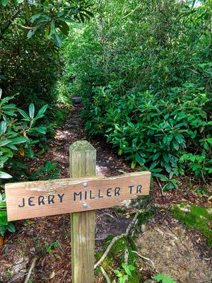
Though this trail is the shortest route to the peak of Mount Leconte, it isn't easy. The trail climbs 1200 feet in its shorter distance making it quite steep. Lower sections of the trail are beautiful and heavily traveled, especially up to Arch Rock...
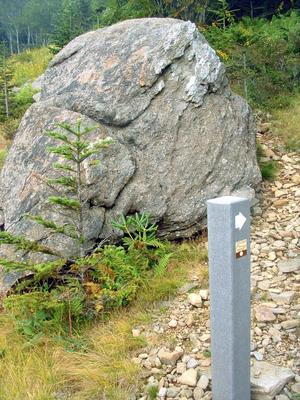
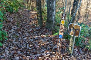
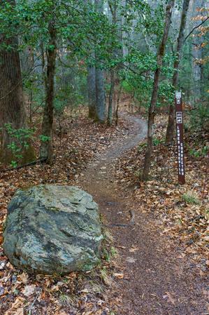
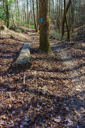
This is a National Recreation Trail and a Kids In Parks TRACK trail. It was constructed by the Youth Conservation Corps. The trail has several interpretive signs along the way which point out common plants, trees and animals which can be found in the...
Starting at the end of the road with the same name, this gravel road trail climbs to end at Sourwood Gap, where it intersects East Ridge trail and Old Mitchell Toll Road.
Follows Armstrong Creek upstream from the end of the Fish Hatchery road complex. Crosses the creek several times along the way. Turns into a drainage northwest of the main stem of the creek and begins climbing earnestly. Ends at the Mountains to Sea...
Starting at the Davidson River Campground, the trail ascends Shut-in Ridge (not to be confused with the Shut-in Ridge near the French Broad River further north, where the long Shut-in Trail begins). It travels through Cat Gap, around the south side...
Starting in Gloucester Gap, this section of the Art Loeb trail winds its way up the ridge extending east from Pilot Mountain before crossing over the summit. It dips down into Deep Gap and Farlow Gap before resuming its climb, up Shuck Ridge, where...
Starting at Black Balsam Road and going generally north, this is one of the most popular stretches of the Art Loeb trail as it crosses over the 6,214 ft summit of Black Balsam Knob. It then winds along the side of the ridge before crossing the summit...
This short section of the longer Art Loeb trail climbs from the Daniel Boone Boy Scout Camp on the Little East Fork of the Pigeon River, up to Deep Gap on the ridge between Shining Rock and Cold Mountain. It's steep, with A spur trail leads to the...
Climbs from the parking area at the end of Black Balsam Road to the top of Black Balsam Knob. Passes through a few switchbacks on its way up. Starts in an open shrubby area, then enters a more forested setting. Touches the spruce plantation on the...
Steep, rocky at northwest (upper) end. Passes through some logged areas. Passes a large waterfall, and through hemlock and rhododendron groves. Southeast end is a standard wet, creekside trail with log bridges. Can be used to make several looops in...
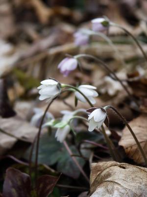
Winds down into a valley where the backcountry campsites are located. The Backcountry Trail is known for the headwaters of the North Fork of the New River and the spring bloom of the Trout Lily.
Features the headwaters of the North Fork of the New...
Bad fork. BAD!
But seriously, though this trail promises to be a potential loop when combined with the Armstrong Creek and Woods Mountain/Mountains to Sea trails, this one is covered with dead rhododendron downfall and is extremely difficult to...
Climbing from Wash Creek Road uphill, the trail follows the ever-diminishing namesake stream along an old road bed, crossing it after a short distance. The forest is a typical cove hardwood variety with plenty of rhododendron and both healthy and...
From FS 472 the trail starts its climb on an old road bed, but soon veers left onto a narrow path for the first of many switchbacks as it ascends the ridge. The switchbacks ensure the grade is never too extreme as it traverses the steep slope many...
This is a short loop through a dense fir forest at summit. Start from the parking area; proceed up the Summit trail and bear left at the sign onto the Mountains to Sea trail. Bear left again at the next intersection to head back to the parking...
Travels from the horse barn near Bridal Veil Falls, past the scenic pastures, and uphill past a small creek to join with the Shelter Rock trail near the bottom of the Airstrip trail. Quickest way to get from the airstrip (and Fawn Lake parking area)...
From it southern end at the junction with the Black Mountain trail, this trail descends Soapstone Ridge and reaches a junction with the Pink Beds Loop trail. It continues straight, passing through the center of the Pink Beds Valley. The valley...
A moderately sloped trail on the north shore of the of the Yadkin river that begins at the turnaround parking area. This trail weaves along a railroad trestle, as well as along the ruins of the unfinished Bean Shoals Canal. (Note: The railroad track...
Follows the creek uphill, starting in a clearing. Travels through mostly white pine and dead hemlocks, then into hardwoods mixed hardwoods near the small stream. Crosses and then ends on FS 5001, making a loop hike possible.
Starting on FS 74, this trail climbs old road beds up to the Laurel Gap trail (another, newer logging road). Beginning as a wide, eroded trough climbing through a gentle cove of mixed hardwoods, the trail climbs past the 4000 ft elevation contour...
Descends a short distance into the small gorge formed by Bearwallow Creek as it drops off the escarpment, to a viewing platform overlooking the falls. Though rated strenuous, it's not really that bad - the surface is well maintained and there are...
Beautiful new trail winds its way up the western ridge of Bearwallow Mountain to the grassy pasture near the top. Travels through rocky woods consisting of oak, hickory, and maple. Passes several neat rock outcrops. The trailbuilders did some nice...
This short trail winds from the picnic shelter up a little ridge on the Blue Ridge Escarpment, through a few switchbacks. It ends at a small viewing platform overlooking a steel tower, and a view out of an electrical transmission line corridor. The...
An easy 1-mile loop around the picnic area. The majority of the trail passes through a large American Beech forest at 4,500 ft. elevation. This is a Kids In Parks TRACK Trail, meaning you can earn prizes for the little ones if they complete and track...
The Belding Trail starts at a suspension bridge over the Cheoah River just off Route 129 in northern Graham County, and runs generally uphill to terminate at Yellow Hammer Gap, a junction with the Hangover Lead and Tapoco trails. Generally following...
Starting at the top and going southeast, the trail climbs ever so slightly onto the wide, open ridge and passes through a wildlife opening. As the trail continues it descends, and the ridge gets narrower and narrower. There are some excellent,...
Connects Lower CCC Trail to Raven Rock Trail. Closest access is 5 mi from the Jacob Fork parking area. The trail serves as a boundary between North Carolina gamelands and the park. Benn Knob Peak is a restricted area. Benn Knob is one of the highest...
Loop trail winds its way up a lush cove beside the West Fork Shut-In Creek and some of its tributaries. Passes several old homesites in a lush cove with big boulders covered in soft moss. Most of the creek crossings are bridge except the upper...
Yes, this really is the trail's name. Starts at the left side (facing away from the road) of the Walker Knob Overlook in Balsam Gap on the Blue Ridge Parkway, heading downhill. (The trail to the right, heading uphill, is the Mountains to Sea Trail)....
Follows one of the larger tributaries of the North Mills River. Many creek crossings on the lower half. Steep climb up the Pisgah Ridge on the upper half. High elevation change.
Follows the Big East Fork Pigeon River. Pristine river scenes. Trail is wide and heavily used near beginning; diminishes somewhat the further you travel. Ends at the junction with Greasy Cove Prong and Bridges Camp Gap trails, providing long loop...
This is a rocky trail to a popular scenic spot that has a 65 foot high waterfall along the Elk River. **Use extreme caution near the falls as fatalities have occurred at this site.**
Yes, that really is this trail's name. The Big Fat Trail starts at the Big Fat Gap Trailhead, reached by a nine mile drive on the FS 62 (Big Fat Gap Road), accessed from US 129 north of the Robbinsville area. This road is gated and closed to the...
Although many sources classify this trail as Easy, I'd bump it up a notch, because it's got quite a few slippery rocky and rooty sections. Still, it's a good family trail overall and it's short. The round-trip to the falls is just over 1 mile, and...
Ascends moderately through mixed hardwoods and then runs slightly downhill along the crest of the ridge on an old logging road. It descends steeply for a brief stretch into the flats right above the cliffs, in an open oak forest. There are a couple...
Climbs steeply from the parking area at the end of Suwannee Drive to the West Ridge trail. Passes through switchbacks in places; some spots require rock scrambling where the trail passes directly over outcrops. Passes through the ridge's eponymous...
Trail is rocky and moderately rough at lower end. Middle part passes over solid granite domes, offering up some nice views of areas within Dupont State Forest and over toward Pisgah. Winds thru dry pine/oak forest near jct. with Cedar Rock trail....
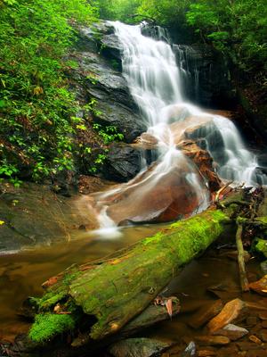
Moderate trail which follows some old road beds and winds onto purpose-built sections of trail. Leads to "Secret Falls". This falls is not so secret anymore.
Big Shoals seems to be one of the original names of the waterfall, but Secret Falls has...
The Big Snowbird Trail is accessed from the Snowbird community area by following Snowbird Road, #1115 off Route 143, then taking Big Snowbird Road #1120 to the end at a trailhead called the "Junction".
From the “Junction” trailhead, the Big...
This narrow trail is extremely steep and follows the slope more or less directly uphill. However, it is short. The bottom portion climbs over a rock jumble and the middle section has more of a dirt tread. The trail passes through several openings,...
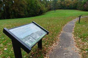
0.9 mi - Easy - This is a historic tour of the Biltmore Forest School, the first school of forestry in America. There are eight buildings along this paved trail, which helps depict the life of a forestry student in the early 1900’s. You will walk...
A series of unofficial, but well-defined, paths which run around the open summit of Black Balsam Knob. The official trail, Art Loeb, passes to the true summit's northwest, but almost nobody uses it compared to these more scenic unofficial paths.
This heavily-used trail features incredible views, hiking along a needle-sharp ridgeline, and lots of rock outcroppings and boulders. The trail itself is notable (unfortunately) for its heavily eroded sections. Either through erosion or work to...
**📝 Note**: The length of this trail is up for debate; see below.
From Bolens Creek's north end at about 3050 ft elevation, this trail follows a recognizable old Forest Service road before becoming more of a foot trail following a more ancient...
A mostly ridge-top trail offering wintertime views in all directions. Climbs moderately and has moderate erosion along its length, leading to the Moderately Rough rating. Connects with the Overlook trail just past the summit of Blackrock Mountain to...
Descends gradually from the Attraction area to a small loop at open rocks, providing views of the Swinging Bridge, MacRae and Attic Window peaks, and Beacon Heights and Grandmother Mountain to the southwest. Rambling through northern hardwood and...
Climbs from the Old Mitchell Toll Road to the summit of Blue Ridge Pinnacle in two places. This is private property, so access to this trail is not guaranteed.
Following an old logging road, Bluff Mountain Loop trail winds its way up the West Fork Shut-In Creek drainage to an elevation of just over 3600 ft. It passes through a forest of mainly mixed hardwoods, including Tuliptree, Read and White Oak, Black...
Easy trail with a beautifully engineered creek crossing on the upper end. From Boyd Branch Road, the trail is graveled to the creek crossing, which also has a hard gravel bottom and large flat paving stones on either side. The rest of the trail is...
Creekside, backcountry trail. Numerous water crossings will require wading; not passable in high water. May require pathfinding skills - trail disappears into the creek at times. Passes small dam on Bradley Creek.
This trail circles around the Briar Bottom Group Campground and runs through a partially-surviving hemlock stand beside the South Toe River. Has a mostly gravel surface. Provides access to the Mount Mitchell, Setrock Creek Falls, and River Loop...
Now the Little River trail.
Old roadbed. Sandy sections. Some rocks; not much climbing. Follows river. Ends at DSF boundary. Unsure whether end that leads to Bridal Veil Falls is on private property; it is not posted - however be sure before hiking.
Gravel road occasionally used by forest service vehicles. Passes the horse stables and terminates at a loop, where a short path continues around a switchback to an overlook, and then the base of Bridal Veil Falls.
Climbs from the hiker parking area through a series of switchbacks through primarily spruce-fir woods, underneath the swinging bridge, and to the upper parking area and buildings. The understory is filled with rosebay rhododendron which bloom in...
Starting on the Parkway in a mixed hardwood/spruce forest, the trail descends over a somewhat rocky path on an easy grade. You'll hear the river in the valley below. The trail passes through one switchback to the left and then into a wetter forest...
From the lower end at jct. with Haywood Gap Trail, the trail climbs steeply up an old logging skid road near Grassy Ridge Branch. The tread is narrow, but generally in good shape and worn well enough to be obvious. The mountainside here is steep and...
Gated, wide, maintained gravel road occasionally used by park and private vehicles (by permit) on the western end down to the Grassy Creek bridge. Rest is an unmaintained old roadbed.
This fairly long trail has several creek crossings on its south end. These are completed via either log bridges or rock-hops and wades. The stream runs through a beautiful cove hardwood forest. There were formerly dense hemlock groves with some huge...
Travels first from the first switchback on US 276 above the Pink Beds to the Pisgah Inn. This is a gradual, pleasant climb that dips into coves & rounds the nose of many ridges with cove hardwoods in the coves and mixed hardwoods on the ridges. There...
Ridgeline trail. Passes some enormous trees. Steep climbs; rocky sections. Passes through pleasant areas with lush grass growing underneath large hardwood trees.
This trail, which doesn't really have a name per se (other than "the loop trail" or "trail: phase 1") is a newly-constructed, machine-built path. It's rather wide, but it was built to accommodate multiple uses (bikes and hikers). It winds through...
This is the third-longest trail in the Appalachian District, after the Appalachian Trail and Mountains to Sea Trail. It also has one of the highest average elevations of any trail in the region, with a long stretch above 5000 ft topping out at about...
Southeast end is mostly on an old road bed, high above the Little River at first. Then switches back and climbs up near the nondescript summit of Burnt Mountain, on and off the old road bed. Steeper on northwest end with some rocks & roots.
The Burntrock Ridge Trail connects the Middle Falls and Big Snowbird Trails with the Sassafras Creek Trail, allowing hikers to bypass some of the stream crossings on Big Snowbird. Starting at Sassafras Falls, the trail climbs to the shoulder of...
Scenic. Starts in Pickelsimer Fields; a flat, grassy area with crystal clear streams meandering through. Typical streamside trail further along. Trailside waterfall. Stiff climb up to Butter Gap; passes headwaters of the stream.
Cable Cove Nature Trail is located on the Cheoah Ranger District in the Cable Cove Campground. Through out the trail there are numerous tree and shrub species identified by trail signs. The trail length is 1 mile and has an elevation change of 1960...
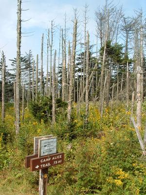
Leads from Camp Alice to the Old Mitchell Trail just above the campground. The Mountains to Sea trail follows this route. Steep and rough, but short and well-built trail that travels through beautiful sections of fraser fir forests.
Connects the Bent Creek Campground with Bent Creek Gap Road. A smooth, level old roadbed which follows Bent Creek part of the way. Interpretive signs. Mixed pine-hardwood forest. Nice bridge right before intersection with Bent Creek Gap Road.
Travels from the Cove Creek trail at Cove Creek Group Campground up Caney Bottom Creek to reconnect with Cove Creek trail near the headwaters. Makes an excellent loop when combined with the Cove Creek trail. Passes several small to medium-sized...
Connects the South Mills River trail with the middle of Squirrel Gap trail. Starting near the old Cantrell Creek Lodge site, the trail follows Cantrell Creek upstream on the river right side to where the former trail continues upstream (now part of...
From the North Road trail, this one starts out going uphill steeply at first, loosely following an old logging road or skid trail. It passes through a couple of switchbacks, one of which is at a small wet-weather stream with a shallow water slide....
Travels through a mixed cove/northern hardwood forest to the Cascades, a high, sliding waterfall that drains the Blue Ridge. Interpretive signs. Gravel surface in places; steeper & rougher near the Cascades.
Currently undergoing improvements, the trail follows an old road from a huge new parking area, built in spring 2012. The first part is an easy walk on an old road bed through level woods. The river is far to the right, and an old pine plantation is...
Level or gradually climbing trail cuts through the upper end of the cove that gives rise to John Rock Branch. The trail swings into smaller head-coves & around low ridges. Passes mainly through a mixed hardwood forest with some hemlocks and...
Starts and ends at the Pisgah Center for Wildlife Education and Fish Hatchery. The loop can be hiked in either direction.
This trail circumnavigates John Rock, a granite pluton similar to its bigger brother just north (Looking Glass Rock). Most...
Interesting trail passes over the granitic dome of Cedar Rock Mtn. Although the mountain is small by mountain standards, this trail provides some great views and an interesting environment. There are some rocky sections near the bottom; rest is...
Accessible from both Stone Mountain Loop and Wolf Rock trails, this trail leads to Cedar Rock, a large granite outcrop with views to the south/southeast and an excellent view of Stone Mountain.
Follows an old road past an old cemetery on a little plateau near the Davidson River. Lots of white pines & hemlocks, & mountain laurel groves. Pleasant little loop.
No unavoidable obstacles. All-access trail to other optional trails. Travels through a mostly young forest, with glimpses of the lake at times. No major stream crossings.
This is a steep forest trail with rock outcrops and tight switchbacks. Climbs 1,300 feet in 1.6 miles from Cold Springs Road to the Appalachian Trail near Max Patch Mountain. Can be used to "Summit" Max Patch over a much more difficult route than the...
Primarily used as a horse trail, but open to hiking. Good connector trail between Cold Springs Horse Trail and Max Patch Road. Follow old logging road through hardwood forest. Park on SR 1182.
Since being re-worked to eliminate the straight-up-the-hill approach, this is a moderate climb through a couple of switchbacks. Only a few rocks and/or roots.
Though technically closed to bikes, it receives heavy bike usage and is none the worse for...
Starts off of High Shoals Falls Loop Trail, 0.2 mi from the Jacob Fork parking area. This trail was rebuilt after the devastating Chestnut Knob wildfire of November 2016; it is well-constructed and easy to follow. The trail ascends on a moderately...
Short, easy loop on a nearly flat summit overlooking the North Fork Catawba River valley - far above the winding passages of Linville Caverns under the mountain below. There are some great views from the primary overlook right near the beginning of...
Fairly short, but very steep especially near the upper end. Takes you to the spectacular cliff-top view on top of the Chimneys - sharp, rocky peaks on a ridge extending from Sugarland Mountain. A gem, although the hemlocks along much of the trail are...
Descends moderately from the town of Blowing Rock on a relocated and improved stretch, following portions of the historic Upper Thunderhole Trail. According to the Blowing Rock Historical Society, the Upper Thunderhole Trail was built in the 1920s by...
{{fig left img="2021-04-18_nantahala-highlands_chinquapin-mountain-trail-mossy-sides.jpg"}}
From the Glen Falls parking area, descends briefly to cross the East Fork Overflow Creek on a sturdy bridge, then begins ascending the valley of a lively...
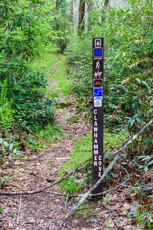
This is a pleasant hike that begins in a small meadow before climbing gently up Clawhammer Cove. There are some nice cascades that can be seen from the trail. Shortly after crossing the creek, the trail follows an old road up the shoulder of a ridge....
Starts at the Clear Creek Dam. Clear Creek Trail is the only trail on the western side of the park at present. This “out and back” trail starts at the Clear Creek Dam and ascends into the Clear Creek Watershed for a quiet, reflective retreat into...
**Note: this trail has been permanently closed.** Traveled along a long, natural ledge in the cliffs of Hickory Nut Gorge, from the parking area to the top of Hickory Nut Falls. Made a great loop with the Skyline Trail. Much of this trail was a...
Far from the side of any cliffs, this easy trail encircles the lake by that name. It passes through the campground and crosses over the dam and beach area.
This trail travels one mile through pine-hardwood forest and climbs to a ridgetop. Signs give trail descriptions along this trail, rated as more difficult.
This 1.5-mile trail follows the same path as the Clifftop Vista Nature Trail. At the ridgetop is a gazebo, the trail offers a panoramic mountain view. After the gazebo, this more-difficult trail continues along the ridge.
From FS 477/Avery Creek Road, climbs a bit through a shallow cove up and over the ridge, then descends into the next cove before resuming the climb up through that. The trail is muddy and wet in places and crosses small tributary branches. Turns...
On clear days the trail has great views of Table Rock, Grandfather and Roan mountains. The trail ascends gently for the first half mile and then climbs steeply toward the terminus at Deep Gap with switchbacks near the top. The trail ends at a flat...
This trail follows a ridge line south of Cold Mountain for its first half, and then traverses to the west of the mountain before climbing to another ridge and ascending the mountain’s western flank. The top of Cold Mountain has plenty of trees on...
This is a short, easy loop around what either used to be or only sometimes is a pond. Whether or not a pond exists, there is definitely a grassy, weedy opening in the forest with a small stream flowing out of one side. The loop is nearly level with...
Primarily used as a horse trail, but open to hiking. Follow Cold Springs Creek through the woods. Park at junctions of NFSR 148 and 3526, or SR 1182 and NFSR 148.
This is an easy walk on a gently sloping gravel road to a historic logging, and later, tourist camp site below the summit. Starts at Stepps Gap at the Park Office. Provides spectacular views of Mount Mitchell and the mountains below. Passes through...
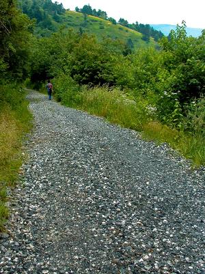
This is a wide, graded, maintained gravel road, which is gated but occasionally used by park vehicles, and private vehicles for visiting the waterfalls (by permit). Passes the old airstrip.
Pleasant loop; you can take this one in either direction but my preference is clockwise. Nothing spectacular, just typical creekside, mountainside and ridgetop landscapes, but it is nicely varied. Loop travels up one cove and down another. Joins with...
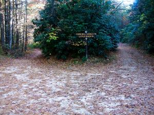
Old roadbed; no longer maintained. Mostly hardpacked, but some places are rocky, highly eroded, or sandy. Starting from the Corn Mill Shoals parking area, the trail fords the Little River at Corn Mill Shoals. Use extreme caution if you cross here:...
From Caney Bottom trail, climbs past Cove Creek Falls on an old road bed, through rich forests far above the stream, to flat areas near the headwaters and then up to Forest Service Road 225B. Unfortunately there is no good connector from the trail to...
Descends from the Cove Creek trail on a fairly steep course through a switchback to the bottom of Cove Creek Falls. Keep right at the side paths leading to the top of the falls; it's not safe to explore that area and the view is no good anyway. Keep...
This excellent trail takes you by the base of one of the most beautiful falls in the area. From the campground, follow the signs to the parking area for the falls trail. Take the right fork where the trail splits. The trail will descend and switch...
This excellent trail travels from the Craggy Gardens Visitor Center up to Craggy Flats and Craggy Knob, then down to the Craggy Gardens Picnic Area. You will first reach the intersection with the Mountains to Sea and Douglas Falls trails. From here...
Starting at the Craggy Dome overlook, this excellent trail travels to the top of a rather pointy mountain, where a spectacular 360 degree view awaits. It is moderately steep, quite rocky, sometimes wet, and has some log steps as well, but it is well...
Although about 80% of the trail surface is in decent shape, it is steep, and some sections are quite eroded and rocky. At least one part is nearly a hand-over-hand climb. Passes by boulders and "crags" - rocky outcroppings that give the trail its...
Climbs moderately along the east side of Shope Creek; a bit more steeply near the upper end. Makes a good loop with the Shope Creek and Forrest Falls trails. Wildflowers, including Dwarf Crested Iris, line the trail in spring.
Ascends 2000 feet from the Blue Ridge Parkway to Calloway Peak - 5964' in elevation. The upper half is rough, but has great views, including one of the Linn Cove Viaduct on the Blue Ridge Parkway. A few in-place ladders and cables help hikers up the...
The naming of this trail appears to be kind of a flub as it's not anywhere near Daniel Ridge itself; instead, the trail is on a spur of Lanning Ridge. Daniel Ridge is two mountains farther west. Described here clockwise, this trail can be hiked...
A mostly moderate hike through pleasant woods, but with some steeper sections. Like nearby Little and Big Lost Cove Cliffs trails, the trail ends at an outcropping with outstanding views across Lost Cove and Timber Ridge, and up to Grandfather...
Follows old FR 475. The road has been re-routed further uphill now. Level or gentle climbs, gravel surface. Davidson River is in scenic small gorge below this road at this point. Several landslides in September of 2004 sent parts of this trail...
The Deep Creek Trail is an interior trail and has no trailheads. It starts at mile 1.0 of the Haoe Lead Trail from the trailhead near the Maple Springs Observation Point. From that point, the trail continues slightly downhill or level for...
Starting at the Panthertown Valley trail downhill from Salt Rock, this trail descends to cross Frolictown Creek just above its small, scenic waterfall. Be careful at the crossing - it's slippery and the falls are just downstream. The trail is an old...
Starting from the picnic area, Deep Gap trail descends to a gap through a dense forest of Fraser fir that have regenerated since the die-off in the 1980's due to Balsam Woolly Adelgid. This is a great place to explore what the native fir forests once...
Short, nice loop. Have a few extra minutes after work and want to burn off some steam? This would be a good choice for a short hike. Steep in places; passes a small wildlife opening. A narrow portion in a nice cove traverses a steep slope and a...
Starting at the Rice Pinnacle parking area, the trail is paved up to the former Deer Lake Lodge site and crosses a long wooden bridge along the way. Beyond the old lodge, which is now marked by a clearing on the right, the trail turns sharply left...
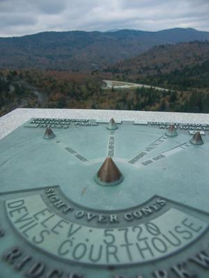
This steep but half-paved path leads to the top of the spectacular Devil's Courthouse. It travels through a high-elevation, spruce-fir forest to an enclosed overlook area at the summit. Identifier plaques on the overlook walls allow you to align your...
Connnects the Mountains to Sea Trail, between the Little Sam trail and NC Hwy. 215, with the Devil's Courthouse trail. Short and mostly level. Passes over the top of the Devil's Courthouse tunnel on the Parkway.
This short trail is located at Black Mountain Campground and passes through a beautiful mixed hardwood forest and by some magnificent boulders. Starting at the amphitheater, the trail goes right and immediately splits left from the River Loop trail....
From FS 74, the trail begins as an easy, 0.5 mile route to its spectacular eponymous waterfall - a great family hike. There are a few tricky sections (including one where a fallen tree has exposed some slick bedrock), but overall the route is in...
A short loop path leads through rhododendrons, up a small grade, and over a few roots and rocks to the falls at a footbridge. This is sometimes called "The smallest named falls on the Blue Ridge Parkway", but its beauty is outsized - and well worth...
Follows the ridge up and over Lookout Mountain, Boggs Bunion, Brushy Mountain and Rocky Head. Ends at Long Gap. here are a few steep sections and several good viewpoints along the trail.
Created for use in the movie "The Last of the Mohicans" ([supposedly](https://www.fs.usda.gov/recarea/nfsnc/recarea/?recid=48534)) and used in the opening scene. Passes through some of the oldest oak and poplar (tuliptree) forest in the area with...
This short path doesn't have an official name, but I'll call it the Entrance Trail since it serves as the public entry way to the main house. It starts as a paved path at the parking area and passes the small visitor center/contact station. It then...
This trail travels to four excellent views of the Upper and Lower Falls. The first overlook takes you to the pool at Upper Falls. From this vantage point you can see the river pouring into the narrorw gorge above the lower falls. The second...
This new, easy trail follows the Davidson River up from the Lowe's in Brevard to the Davidson River Campground, connecting to the city of Brevard's greenway system. Easy, nearly level trail with some nice riverside scenery. Passes a large rock cliff...
The Exclamation Point trail leads from the Chimney to the eponymous point in Chimney Rock Park, a rock outcropping overlooking the Hickory Nut Gorge at 2480 ft. This strenuous trail finds you looking down over Chimney Rock and Lake Lure as you start...
Travels on mostly old roadbeds; only a couple of steep sections. Crosses Beaten Branch a couple of times on the northeast end; this can be wet. Re-routed section near Cold Creek Knob Road is steeper with several switchbacks. Explorer Loop Alternate...
Crosses Shope Creek at the gate, then climbs through a clearing and into the forest beside a tiny wet-weather stream. Climbs steeply at the end before reaching an old logging road/trail.
An easy walk, mostly on an old roadbed, to the base of this beautiful waterfall. Starting in some old farmland with exotic flowering plant species, the trail then passes through a bottomland forest of hemlocks and hardwoods, with some big boulders on...
Follows an old logging railroad grade from the start at the junction with Daniel Ridge trail in the Right Fork cove. From there, it passes a large sloping rock slab and then crosses Right Fork. This can be a tricky crossing to stay dry; it will be...
Follows an old railroad grade up from NC 215 to the end of FS 816, the Black Balsam parking area. It's a gentle climb on a wide trail; it's very rocky all the way. It's also a unique trail since it's entire length is above 5000 ft. elevation.
Starts...
Typical streamside trail for the most part, with cove hardwood forests, hemlocks, fern gardens and log bridges. Some muddy sections are out there, but the trail is mostly dry. It passes through some open meadows rimmed with flowering dogwoods near...
As Florence Preserve's longest trail, this one has a variety of character. From Kelly Mountain Road up to the Yellow trailhead connector, this is a narrow, slope-side trail with a couple of creek crossings on log bridges. Some neat trees grow here,...
Not to be confused with the other orange trail in the preserve, this a short, narrow side path to an overlook called Rattlesnake Knob off the Red trail. This is the best overlook in the Preserve, in my opinion, with some good views to the west up the...
This is the orange trail (one of three) that leads from the Blue Trail out to "Tom and Glenna Rock" (formerly Little Pisgah Point). It's a gently-sloped old road bed, which passes near an opening in the forest that lets in a lot of light and lets...
Climbs steeply from Kelly Hill Road, up to the top of the ridge. Parts of this segment are heavily eroded. Beyond the Orange overlook connector, this levels out - it's an old road bed - and there are some sections with lots of poison ivy to watch out...
This is one of two yellow trails in Florence Nature Preserve. The other is the main access trail from the Upper Hickory Nut Gorge parking area. This one is an old road bed which climbs from the blue trail up to the white trail. It is steep and narrow...
Climbs, steeply at first, from the new trailhead on US 74-A (the old chimney) to the Blue Trail near the main stream. Passes near some very steep areas near the beginning; use caution, especially if you have kids (the trail itself is quite safe)....
A network of paths through the forest south of
The Forest Festival Trail is open to the public during the Cradle of Forestry’s season, and guided walks are also available during this period. Annual schedules vary, so be sure to check at the...
This trail follows the ridgeline and ascends and descends frequently over several mountain tops most notably Birdstand Mountain. From the top of these mountains the view can be obscured by trees but the few glimpses you get will show vistas of the...
This trail steadily climbs through upland hardwood forests and rhododendron thickets. After the initial ascent, the trail mostly follows ridge tops offering views of Big Creek drainage. The best viewing times are early spring, late fall and winter....
Leads from the Shope Creek trail across a tributary of Shope Creek to the top of Forrest Falls. Provides connections with "Crested Iris" and "Upper Shope", making some loop possibilities. The lower part is identified as "I" on the Shope Creek logging...
Pleasant, easy trail travels through the lowlands beside Foster Creek, in a rather detached section of Pisgah National Forest. No intersections with any other trails (except the old logging road). Mostly white pine and cove hardwood forests, with an...
Winds its way uphill from the upper end of the Meadows area to the Hickory Nut Falls trail. Smaller kids will have trouble on this one, but it does offer one of the longer hikes in the park and - combined with the Hickory Nut Falls trail - a more...
Connects Lower CCC Trail to Raven Rock Trail. Closest access is 4.1 mi from the Jacob Fork parking area. This remote trail has an expansive vista of the Blue Ridge at the eastern end of the trail. It descends to Nettle Branch and then winds around...
An easy path around Front Lake - more of a large pond than a lake, but pretty and relaxing nonetheless. There are some great views up thru the front pasture to the main house from this loop. There are connecting trails up to the main house and the...
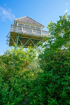
Besides having one of the most interesting names on the Parkway, Frying Pan Mountain has a fire tower on top which hikers can climb for excellent views in all directions. It's a great place to see Mount Pisgah's profile as well as Cold Mountain and...
This old, unmarked logging road (becoming more of a trail) connects the Art Loeb trail down to FS 471D, an old logging road, which leads on down to FS 471, Catheys Creek Road, opening up some loop possibilities.
**Note:** This trail was closed permanently in 2010. Use the Triple Falls trail instead.
Newer, short trail winds up through several switchbacks from the Hooker Falls parking area up the hill to the picnic area at Triple Falls. Named for large...
The trail follows Flat Creek, and has many informative signs and nice benches on which to rest. This trail as an extension of the Nature Trail and includes "Elizabeth's Path", which was named for Elizabeth Peterson who loved to walk along this creek....
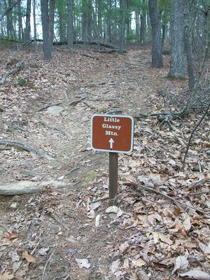
Also called just the "Glassy" trail, this one climbs from near the main house up to the round, flat summit of Glassy Mountain, which is the highest point in the park at 2783' elevation. This one is a bit steeper and is longer than the rest of the...
Three waterfalls along East Fork Creek are collectively known as Glen Falls, and are well worth the effort required to reach them. The trail travels downhill, starting at the back of the parking area. The trail emerges at the top of the first falls,...
Follows the length of Grandfather Mountain's summit ridge from the Attraction area near the Swinging Bridge to the summit of Calloway Peak. Travels through a spruce-fir forest, up and around rock walls and pinnacles, and through open meadows. There...
From the hiker parking below the summit, climbs through a series of switchbacks in a spruce-fir forest (with a healthy helping of blueberry and rhododendron shrubs in the understory). Rocky and rooty in places, with a couple of wood structures to...
In addition to providing access to the long, sliding Granny Burrell Falls, and the huge pool downstream of them, this trail travels near some neat portions of Panthertown Creek. A Carlton McNeil classic, it twists and turns through some of the...
From the eastern end, the trail - which is an old road - ascends slightly, then crosses a tributary of Briery Fork before going through its eponymous meadow, surrounded by a forest filled with white pine. It descends again to the west junction with...
An old road bed that is becoming a trail again. Moderate climb near the junction with Thrift Cove; levels out near the junction with Sycamore Cove. The open forest along the trail is filled with Appalachian Hill Cane in many areas.
This loop travels through a unique, high-elevation, flat valley to a spectacular cascading waterfall. Braided streams, open valleys, short high-elevation forests, rhododendron & galax groves, clear pools. See Also the Graveryard Fields Best Hike.
Follows an old railroad grade through thin forests above Graveyard Fields valley. Mostly northern hardwood trees with a few spruces &/ firs near the intersection with the Mountains to Sea Trail. & the Ivestor Gap Trail. Rocky & wet in a...
Crosses Flat Creek on a bridge and goes upstream on a steady uphill course. Past the Harry Bryan trail, the trail enters the Boggs Wilderness and climbs along an old roadbed. It crosses Flat Creek again, turns into a purpose-built singletrack trail...
This trail initially traverses Grassy Cove Ridge at or near its crest, with minimal views other than of the Parkway, until it drops down to Greasy Cove Prong. Caution: The trail is especially difficult to see during this descent. It follows the prong...
This trail was previously considered two trails by most, but the Forest Service has officially combined them into one. For this reason, it has two distinct characters on the two different sections that now share the same name. Starting on the Deep...
Perfect introductory hike for families with small children! Woodland creatures take the spotlight at 12 discovery stations along this easy winding trail at the Meadows, giving the little ones motivation to keep going to see what's next. On...
This trail follows a ridge line to the Green Knob Lookout Tower at 5,090 feet. The trail is very steep and gets rocky so some minor scrambling is required. The trail provides amazing views of this beautiful mountainous region. After 2.8 miles the...
Formerly called Carlton's Way, named after Carlton McNeil. Carlton was a nearby resident who loved the Panthertown valley and was known locally as its "keeper". He blazed many of the trails in the area, including this one, and his trails...
Climbs steeply from the river valley to the top of Green Mountain, and then travels along Fork Ridge. Variety of forest types culminating in a spruce-fir forest near the top. Scenic, wilderness travel.
This trail begins at the gate on FS 3509 and follows gravel road for one mile. At this point, the trail leaves the gravel road and follows an old wooded road into a cove. The path then steadily climbs Green Ridge and crosses Dry Creek headwaters. The...
This trail follows Groundhog Creek for most of its length. Just below the Appalachian Trail shelter the trail crosses an old road. Water is available along the trail and at the shelter. Offers 9.5 mile loop: Combine with Groundhog Creek, Rube Rock...
Winds its way down in to the Gully Creek valley, passing a small but picturesque waterfall and crossing the stream on step stones and a foot bridge along the way. It climbs again and crosses the summit of Cumberland Knob, which a small grassy...
This is the most direct way to reach Hanging Rock itself, and is probably the most popular trail in the park. The trail is wide and has a gravel surface for most of its length, but gets narrower and rockier near the top.
From the picnic...
The Hangover Lead Alternate Trail offers access to the Hangover, a rocky point with a 360 degree view of the surrounding mountains. Starting at a junction with the Hangover Lead “South” Trail on the ridge, this trail goes north, passing through ...
Hangover Lead Trail is often described in "North" and "South" sections, as the trailhead is in the middle of this interior trail. The Big Fat Gap Trailhead is at the end of the 7 mile long Forest Service Road #62. This road starts across a bridge...
The Haoe Lead Trail is an important trail in the southern portion of the Joyce Kilmer Slickrock Wilderness, providing connections to six other trails in the area. The portion along the Stratton to Haoe Ridge are moderately used and easy to follow,...
Although this trail is listed as "easy" in some publications, that's not really the case. It might be considered moderate if you only hike to the falls and back, but the whole trail is much longer than that. And the multiple creek crossings, sparse...
A gentle up-and-down hike through the woods of Bell Forest to Flat Creek and a bridge at the Graybeard trail. Makes a nice, easy 1.8 mi loop when combined with Graybeard and/or Julia Woodward/Sanctuary trails.
{{fig right img="2017-10-01_pisgah-linville-gorge_hawksbill-trail-rocky-climb.jpg"}}
Climbs along a newer alignment from the trailhead parking on Table Rock Road, where the trail is generally in good shape. Passes through a few switchbacks so the...
Starting at FR 97, Haywood Gap Trail climbs alongside the Middle Prong of the West Fork of the Pigeon River all the way up to the Mountains to Sea Trail about 75 yards from where it crosses the Blue Ridge Parkway at Haywood Gap. Parts of the trail...
Starts at the Shinny Creek picnic area, 0.5 mi from the Jacob Fork parking area. The trail provides access to Shinny Creek Trail, the Shinny Creek Backcountry Campsite and the Upper Falls Trail. One of the main artery trails which provides access to...
This easy, accessible trail follows the beautiful Jacob Fork River. There are many interpretive signs along the way, explaining various aspects of the geology, flora and fauna of the area. You'll also pass the amphitheater where interpretive programs...
The Hickey Fork trail travels through the Shelton Laurel Backcountry Area. It should be treated as such; only those experienced in wilderness travel should attempt to hike all of it. More casual hikers will enjoy an out-and-back trip to the falls on...
The orange-blazed trail starts across the road from the parking area, on the hill behind campsite #16c. Look for the tall brown stake which serves as the trailhead sign. The trail begins by climbing to the top of the ridge. Don't go straight up; turn...
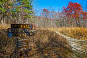
This trail was rebuilt in the spring of 2014 by Elevated Trail Design. Climbs past an open meadow through some switchbacks before winding around atop Hickory Mountain a bit, and crossing the summit in a nondescript forest setting. There are a couple...
Old gravel road travels from the meadow near Guion Farm to the bottom of Hickory Mountain, where it connects to Hickory Mountain Loop and Ridgeline. Mostly gravel; travels through pine forest. Passes through another clearing near the upper end with a...
Following an old jeep road, this trail leads through a mixed hardwood forest to the base of 404-foot Hickory Nut Falls. Some sections are rocky, but the hills are generally mild and children should be able to reach the falls. This trail was formerly...
Travels from the summit of Lookout Mountain to the Old Mitchell Toll Road. The Rattlesnake Mountain trail is 180 ft south and passes onto private Ridgecrest Conference Center property, which is closed to use by the general public.
This trail branches off from the Mount Mitchell Trail. The trail gently climbs Higgins Bald where old cabin foundations exist. It breaks off to the left from the Mount Mitchell trail after about 1.5 miles and rejoins the yellow blazed Mount Mitchell...
This "trail" has a several different parts to it. Starting at the High Falls parking area, a new section of footpath parallels Buck Forest Road and leads to the south intersection with the Triple Falls trail near the covered bridge. It's nice because...
From the parking area away from the lake, the trail begins as a gated road leading down below part of the dam. It winds downhill on a graveled path to a hairpin turn near a drainage basin, then turns right at a sign. From there the trail becomes much...
This short, but steep, and very popular trail takes hikers about a mile to High Shoals Falls. All junctions are signed and the tail is well blazed.
Starts at the Jacob Fork parking area on an old road to the right of the picnic area. (You can also...
This easy 1.5-mile trail starts near Cliffside Lake Dam, follows Skitty Creek and connects with a road that meets U.S. 64 halfway between Dry and Bridal Veil Falls.
This trail was recently completely re-graded. Travels along the shore of Lake Powhatan. Passes through the beach area and past the dam, then downstream along Bent Creek. There are a few footbridges and some wet places, but it's otherwise a fairly...
The Hooper Bald Trail is at Milepost 8 on the Cherohala Skyway in western Graham County. The parking area has a nice interpretive display and paved parking. The trail leaves from the parking area and travels east to a large expanse, "the Bald", with...
This is a short, but fairly steep connector trail, which enables some long loops for all users. This trail will take you through a nice stand of cove hardwoods, made up mostly of yellow poplar and oak. In the winter, you can see some of the distant...
Connects Lower CCC to Upper CCC. Closest access is 4.8 mi from the Jacob Fork parking area. This is a remote strenuous ridgeline trail that offers views west to Walker Top Mountain and the Blue Ridge Mountains. Views of the Black Mountains, Table...
This trail is a co-signed as a portion of the Mountains to Sea Trail and takes you to a popular, yet small, waterfall on Lost Cove Creek.
From the well signed trailhead on FR 464, the trail descends moderately through a few switchbacks and then...
The Ike Branch Trail is an interior trail with no trailheads. It starts as a junction on the Slickrock Creek Trail approximately 0.5 miles from the Slickrock trailhead, and climbs very steeply for 0.9 miles to the top of the ridge, which marks the...
This path is also part of the Mountains to Sea Trail. From the picnic area and trailhead parking, the trail goes 0.4 miles to Hidden Falls (easy), then reaches Window Falls at 0.6 miles (moderate). It continues past these small, but neat, waterfalls...
Similar to the Flat Laurel Creek trail, this trail follows an old railroad grade. It travels around Black Balsam and Tennent Mountains. It is level or climbs gently in places. It is very rocky and very wet, although there are no sizeable stream...
Starting at the tip of the River Ridge Loop trail, Jack Branch climbs along an old road bed in places, while in others it slips away to amble along the ridge. The forest burned in the early 2000s in this area, giving it an open feeling except where...
Connects Upper Falls Trail to Fox Trail. Closest access is 3 mi from the Jacob Fork parking area. This moderate foot trail crosses Jacob Branch and ascends southwest to Fox Trail. Walk along the riparian area of Jacob Branch.
The Jenkins Meadow Trail starts on the entrance road to the Joyce Kilmer Memorial Forest and climbs to a junction with the Haoe Lead Trail. Approximately 1/2 mile from the trailhead is a junction with a connector trail leading to the Naked Ground...
Formerly known as the Whiteoak Flats trail. The trail leaves FS 111 from parking on the road’s left side. The trail is especially scenic in late spring when the rhododendron and mountain laurel are in bloom.
Crossing Big Creek and climbing a...
Dead-ends on the backside of Joanna Mountain. Would make a great trail if it traveled to the overlooks on the front of the mountain, but you'll have to bushwhack to get there for now. This trail is no longer maintained and is closed to bikes and...
Starting at the southwestern intersection with Cat Gap Loop trail, this trail starts is steep and rocky as it heads up over the first summit highpoint. Travels north over a wide ridgeline to the face of John Rock; there are 3 smaller summits to cross...
This figure-8 loop trail travels through a spectacular, virgin forest, one of the largest contiguous tracts of old-growth forest in the Eastern United States. The forest around this trail is designated as the Joyce Kilmer Memorial Forest, a part of...
The King Meadows Trail generally follows the northern edge of the Snowbird Backcountry Area. It can be accessed from the Hooper Bald Trailhead at Milepost 8 on the Cherohala Skyway, following the Hooper Bald Trail just a few feet to the junction, or...
Climbs a tributary of Shope Creek through a beautiful cove from Wolfden Flats to a (semi-) dead-end at the head of the cove near a large, angled rock feature below Lane Pinnacle. Unofficial scratch-paths head off in several directions from there.
...
This is a long, late 80's era logging road (FS 5548) that traverses the forest roughly parallel to (but a higher elevation than) FS 74, the main road through Big Ivy. As much of the area was logged after this was constructed, the forest along this...
Long, narrow, backcountry singletrack trail which reaches high elevations. Climbs gradually from Yellow Gap Road (FR 1206) to the Buck Spring Trail; however, there are a few steep sections. Several unmarked trails join from either side, so keep an...
This trail follows Big Laurel Creek through a scenic gorge to its junction with the French Broad river at the old logging ghost town of Runion. This trail is especially nice in early spring when there are many wildflowers blooming along the path and...
Starting at Curtis Creek Road, travels south along the ridge with stellar views. Past the junction with Hickory Branch Trail, descends to Mackey Creek Road on an unmaintained segment.
Connects Wolf Branch trail to Rice Pinnacle Road (FS 479E), crossing Wolf Branch at a muddy area with huge ferns along the way. Climbs moderately toward the road through a young forest. Watch for blazes.
Longest trail at Tsali. Starts with many sections along the Lakeshore with dips into coves to cross small streams; towards the overlook, climbs further into the interior ridges with no major climbs. Connects with Overlook Loop and uses County Line...
This easy, paved path provides access to the underside of the Linn Cove Viaduct, an engineering marvel of the Blue Ridge Parkway. This structure was built from the top down, allowing the fragile environment beneath it to be relatively undisturbed....
The trail climbs and follows a ridge above Little Andy Creek. The trail emerges on Laurel Gap Trail about 100 feet from Upper Corner Rock Trail on the left. You will pass a seemingly misplaced large granite boulder on the left.
Can be made into a...
Access is past Daniel Boone Boy Scout Camp off of NC 215 near Bethel, NC. Continue on SR 1129 to trailhead. Please notify camp staff if you are going to leave a vehicle at the camp.
{{fig right img="2018-10-14_panthertown-valley_little-green-trail-schoolhouse-falls-autumn.jpg"}}
This trail first takes you to Schoolhouse Falls (if starting on the northeast end at the Panthertown Valley trail where it crosses Greenland Creek,...
Starting at Boyd Branch Road, the trail climbs through several switchbacks through logged areas. The surface is a logging road which used to be a singletrack trail historically called Sidehill, but was revived into a road around 2005 (and is now...
A nice trail leads to the eponymous rock outcrop from which unfolds a spectacular view of the Blue Ridge Mountains, with Grandfather Mountain framing the horizon. Most of the trail follows old road or skid road beds; it is moderately rocky in places...
Starts at the Jacob Fork parking area. The trail crosses Little River and connects to the Upper CCC Trail. Horseback riders share part of this trail with hikers. Views of the Little River.
Follows an old roadbed. Mostly smooth with some sand and rocks, and one creek crossing (Tom Creek) with a log bridge. Not much in the way of elevation change. Follows the river in places. Ends at the State Forest boundary above Bridal Veil Falls. The...
Connects the Flat Laurel Creek to the Mountains to Sea trail, providing several loop options. High elevation trail. Follows old road/railroad grades with one larger stream crossing. Very muddy and wet, and somewhat overgrown. Passes above a very...
Trail passes through the interesting, relatively flat Long Branch valley near its western end and up and over some low ridges farther east. Some muddy sections near the west end have been reinforced with puncheon and/or rock & gravel causeways;...
Longer loop circling Max Patch Mountain. Descends into some beautiful meadows lower down the mountain with views back up to the top. Rhododendron tunnels. One section passes by the headwaters of a tiny stream, where a few very old, fat trees grow....
A classic Pisgah trail. Travels first through small cove, then steeply up the back side of Looking Glass Rock through many switchbacks. Mixed cove hardwood, hardwood, and pine-oak forests. Some areas of rare Carolina hemlocks. Rock slabs. End of...
Climbs moderately through a nice cove before a few switchbacks on new stretches of trail up to the Old Trestle Road. Climbs steeply beyond Trestle Road along the ridge with stairs in places. A few stretches just before the overlook have exposed rocks...
Travels along the south-eastern facing slope of Mount Jefferson. The moderate Lost Province Trail explores a virgin oak/chestnut forest, providing views of false Solomon's seal and other understory species.
Climbs steeply from the Silvermine trailhead parking area to the Appalachian Trail, near the top of Lovers Leap Ridge. The Silvermine trailhead is across the French Broad River bridge from downtown Hot Springs. The main overlook, located at a rock...
From the parking area off of Hall Rd., the Lower Cascades trail winds through level, young woods up to the edge of a little gorge Cascade Creek has carved as it cuts down to the Dan River. Upon reaching the "rim" of the gorge, the trail descends over...
Connects Benn Knob Trail to Horseridge Trail. Closest access is 4.3 miles from the Jacob Fork parking area. The Lower CCC Trail was named for the Camp Dyer Civilian Conservation Corps (CCC). The trail follows a ridgeline that separates the Henry Fork...
A traverse around the foot of Big Piney Ridge. From the south trailhead at Harmony Road, this beautifully constructed trail winds along the rocky mountainside, climbs through a few switchbacks, and passes a couple of nice viewpoints and...
A steep climb near the south end gives way to a sidehill traverse, mostly on old road beds, before descending to lower elevations and smaller hills near the north end. This is one of the more remote-feeling sections of trail in Bent Creek. Passes...
The infamous Mackey Mountain trail starts near the top of Curtis Creek Road and heads southeast. This trail begins well enough, winding along and across the ridgeline past Sams Knob and over to Narrows Knob. It's a well-graded path in most places,...
Provides the quickest access to Greenland Creek Falls from the Cold Mountain trailhead on an old road bed. Then, ascends into the heart of the valley and descends again between Big and Little Green Mountains. Can be used to make a ton of loop options...
Begins at the office and connects to the trailhead parking area, and also ties into the Beech Tree Trail for an easy loop. Designed for cross country skiing and hiking. Wake Robin and Giant Trilliums may be seen from the trail in spring.
The Maple Springs Accessible Trail is a short walk to a wooden lookout point, with a great view to the north, east and south, with the western end of the Great Smoky Mountains National Park in the middle of the viewshed. The Yellow Creek Mountains,...
A pleasant loop around Little Glassy Mountain, starting and ending at the main house. Some parts climb noticeably although even most kids will be able to handle this one. Passes thru some nice forests and over a small rock outcrop, and thru...
The Middle Falls Trail is an interior trail, providing a high water alternative to the Big Snowbird Trail in the area of the Middle Falls. It intersects with the Big Snowbird Trail and with the Middle Falls Alternate Trail to provide easier access...
The Middle Falls Alternate Trail is an interior trail, providing a high water alternative to the Middle Falls Trail in the area of the Middle Falls. It intersects with the Big Snowbird Trail and with the Middle Falls Trail to provide easier access...
Accessible from Stone Mountain Loop Trail, this trail leads hikers a half mile along
Big Sandy Creek to Middle Falls and then extends to Lower Falls. The trail dead-ends at Lower Falls.
The trail follows an old railroad grade; you may notice some of the old ties still in the ground. It follows or crosses the Middle Fork of the North Mills River for its entire length. You will pass some wildlife fields, which are maintained by the...
The trail starts at the back of the parking lot and begins going up a very long set of concrete and wood steps. There are hundreds of them. It's short, though. At the top of the steps, the path turns back into a wide trail and levels out. It's just a...
The Mitchell Lick Trail connects the King Meadows Trail and Big Snowbird Trail at the upper/northwestern end of the Snowbird Backcountry Area. Headed westerly, the trail leaves south of the McGuire area and heads downhill for approximately 0.25...
Travels beside a scenic stream to 70' free-falling Moore Cove Falls. Beautiful open cove hardwood forest with fern gardens. Several plank bridges & log causeways over wet areas. Rock outcroppings. This trail makes an excellent hike for families,...
Connects the Second Falls spur of the Graveyard Fields trail to the Mountains to Sea Trail. Can be used to access the Skinny Dip Falls area from Graveyard Fields, or the other way around.
**Clingman's Dome to Waterrock Knob**
From the start of the trail at Clingmans Dome on the Appalachian Trail in the Great Smoky Mountains National Park (north), to the summit of Waterrock Knob off the Blue Ridge Parkway. The trail is all on existing...
**Waterrock Knob to Pisgah Inn**
From Waterrock Knob to Flat Gap, the trail follows the Blue Ridge Parkway closely at most times. It gains some distance from the motor road on the southwest slope of the ridge line from there to Haywood Gap.
From...
**Pisgah Inn to Black Mountain Campground**
Pisgah Inn, BRP mp 408.6 to Folk Art Center, BRP mp 382: from the Pisgah Inn to the Mount Pisgah Parking Area, the trail is co-signed as the Buck Spring trail. This leads past the old Buck Spring Lodge...
**Black Mountain Campground to Beacon Heights**
From Black Mounain Recreation Area by South Toe River in Pisgah NF to Buck Gap at BRP mp 344.1: Climbs the ridge. From Buck Gap at BRP mp 344.1 (NC-80) to Woodlawn Park (US-221): The MST leaves the...
**Beacon Heights to Devil's Garden Overlook**
Beacon Heights, BRP mp 305.3 (near Grandfather Mountain) to Blowing Rock (US-321) BRP mp 291.9. Among the co-signed trails followed by the Mountains to Sea Trail on this stretch is the exceptionally...
**Devil's Garden Overlook to Pilot Mountain State Park**
Devils Garden Overlook BRP mp 235.7 through Stone Mountain State Park to its headquaters parking area. Follows some named trails, but other trails are to be selected by Stone Mountain State...
**Pilot Mountain State Park to Hanging Rock State Park**
From Surry County boundary through Stokes County: (This section includes 7 miles of trails in Hanging Rock State Park.) The Sauratown Trail that connects Pilot Mountain to Hanging Rock has...
This long, strenuous trail leads from the USFS Black Mountain Campground to the summit of its namesake mountain. Most of the trail is on USFS property. Climbs 3600 ft in 5.5 mi, making it one of the highest single-trail climbs in the region. It's...
A classic Blue Ridge Parkway hike. Travels from the Mount Pisgah parking area along a gently climbing, moderately rocky trail until it gains the ridgeline; then gets steeper with rougher tread condtions. Hardwood forest of mostly oaks with a few...
Trail passes through some clearcuts, through some intact sections of forest. Shortest Tsali trail. Connects with new, 2.5 mile Mouse Branch Overlook Loop with excellent views of Fontana Lake. Like all the trails at Tsali, no steep climbs and no major...
One-way trail (counter-clockwise), but this mainly applies to mountain bikers and horses. Good view from the overlook. Several neat islands lie below you in the lake.
From the S. Mills River trail, climbs on an eroded old roadbed through nondescript forest to a nice campsite in a gap, just after crossing a small stream. The trail makes a hard right to the north on another road bed, which heads uphill into the...
The Naked Ground Trail is an interior trail with a 2,500 foot elevation gain, most often accessed from the parking area at the Joyce Kilmer Memorial Forest. Follow the right hand portion of the Memorial Loop Trail for approximately 0.5 mile to the...
The Nichols Cove Trail is an interior trail and has no trailheads. The trail starts on the northern end at Mile 4.5 of the Slickrock Creek Trail. From that point, the Nichols Cove Trail is a very wet trail through rhododendron growth for...
Climbs from the Harper Creek Trail above Harper Creek Falls, past Bard Falls and North Harper Creek Falls, ending on Kawana Road. Several creek crossings and a wilderness setting add to the difficulty of this trail, which would otherwise be rated as...
75% of this trail is in great shape; travels along an old roadbed through beautiful woods with few obstacles. Judging by the size of the trees growing on the roadbed, it's been here a while. The last little bit turns into a true foot path and is a...
This trail is co-signed as the Mountains to Sea Trail. It's a shortcut from FS 464, Pineola Road, down to a beautiful section of the North Harper Creek trail about a half mile above Bard Falls. This trail is the easiest way to the falls, but it's a...
This neat little loop starts and ends in the Davidson River campground, making it a must-hike if you're staying there. Described counterclockwise, but can be hiked in either direction.
Starting at the campground's amphitheater, the trail climbs an...
Follows an old logging road. Easy but rocky; ends at Storyteller's Rock and a spectacular view of the Boone Bowl valley and up to Calloway Peak. Stream crossings, rhododendron tunnels, a spring channeled through a sluice, a stand of big-tooth aspens,...
This trail follows Chestnut Ridge and crosses several knobs that provide nice views of the surrounding Shining Rock Wilderness. In the first half mile after leaving Shining Creek Trail, it climbs very steeply, gaining about 1,400 feet of elevation,...
Leads from the park office to the Summit trail. Travels through a dense spruce-fir forest; though the trees are mostly firs along the ridges. There are some wet, rocky, steep and/or exposed cliff sections. Provides spectacular views of the summit...
Short spur leading from the park campground up to the the Old Mitchell trail below the summit. Go straight to reach the summit; right to get to the Camp Alice trail and the rest of the Old Mitchell trail.
Follows a tourist road which once provided motorized access to the summit of Mount Mitchell from Black Mountain after the logging operations and tourist railroad had winded down. The toll road largely followed the old railroad's path, but the town of...
This is a historic logging and tourist railroad grade that once went from Black Mountain to Mount Mitchell in the early 1900's. It is called the "Trestle Road" because of the three trestles it once needed to span creeks along the route. Between...
A series of paths (each with its own color blaze designation) leads downhill on a moderate-to-steep grade toward Otter Falls, with a short stretch of path following the creek below the falls. The trails follow old roads in places and are newly-blazed...
**Note:** the old all-wood staircases have been removed and replaced with sturdy state-park style steel and wood structures. The Needle's Eye spiral staircase has been removed.
This "trail" provides walking access to the Chimney in lieu of the...
Crosses the very summit of Blackrock Mountain before descending to the cliff areas for spectacular 180-degree views of Big and Little Green Mountains, and the entire Panthertown valley. The cliff-top viewing area has some nice flat spots to hang out...
This is the main trail through the valley which stretches from the Cold Mountain entrance to the Salt Rock entrance. Portions of this trail are open to horses and/or bikes. It passes near many of the main attractions within the valley, so many loop...
Getting directly to the top of the Chimney from the main parking area is mostly indoors, and consists of a short walk through a man-made tunnel, a ride up an elevator, a walk through a gift shop, a short walk along this cliff-top path, and then a...
Also known as Perkins Road. Climbs steeply on an old road bed from FS 74 to the Laurel Gap trail. Starts in a fairly nondescript cove hardwood forest setting but quickly reaches some areas with very large, impressive trees as it winds its way up into...
Trail begins on SR 1327 and intersects with trail 255. It's a 10-15 minute hike to a 40 ft high sliding waterfall on the stream that share's the trail's name, but it's a difficult scramble down a bank to the best view. A smaller waterfall is upstream...
Short gravel path connects the two main picnic shelters over a small hill and through some nice woods. Pretty ferns and mountain laurel (blooming in late May) grow beside it. For maximum hiking distance, park at the northerly picnic area, take this...
In what could be one of the most bizarre naming situations in all of Pisgah, this trail is neither in a cove nor is it a loop. Rather, the best reasoning I can come up with for its name is that this ridge-top trail *enables* you to hike a loop above...
Starting at the eastern end, this trail begins by following Slate Rock Creek. This is an easy to moderate grade with several stream crossings. Slate Rock Creek is typical of mountain streams, with small cascades and an abundance of mosses and ferns....
Climbs somewhat steeply from Yellow Gap Road (FR 1206) up to the Buck Spring/Mountains to Sea trail near Mount Pisgah on the Parkway. Initially crosses a creek, then climbs through a cove forest gradually getting farther from it. Passes through many...
Starting on the west rim of Linville Gorge at the parking area on Kistler Memorial Highway, the trail descends the gorge steeply all the way down to the Linville River 1700 vertical ft below. It passes first through some mid-elevation forested areas...
A 4 mile trail that begins at the Wilson Creek Visitor Center and winds its way over to a junction with Raider Camp trail, touching Pine Ridge Connector and Phillips Branch along the way. This makes for several longer loop options in the vicinity.
Connects the Pine Ridge Trail to FS 198, Chestnut Mountain Road. Using this road, creates loop opportunities by combining the Mountains to Sea, Raider Camp, and Pine Ridge trails, or longer loops using others.
An excellent loop which travels around the bottom of a unique valley. This is the "Cradle of Forestry in America", where modern forestry techniques were first developed, taught & practiced. Trail is mostly level with a few small hills on north...
A scenic trail with gentle grades. West of Joanna Road, the trail goes through second-growth forest with only a few bigger trees (mostly white pines). There are some nice areas of galax, and a couple of neat, mossy rocks beside the trail. East of...
From the visitor center, this trail starts out fairly smooth through a forest of very large hemlocks and white pines to the junction with the Plunge Basin overlook split. The trail to the overlook is downhill and has some obstacles, but is well...
This greenway path/trail follows the route of old US Hwy 70 on a steady grade up the Blue Ridge Escarpment from the valley near Old Fort to the top near Ridgecrest. It's a strip of asphalt down the old concrete roadway. Hemmed in by a hardwood and...
Can be reached via Shinny Trail. Closest access is 1.6 mi from the Jacob Fork parking area. The trail can be combined with Chestnut Knob Trail to make a 7.7 mile loop that is one of the most popular extended hikes in the park. Leaves the Shinny Creek...
Poundingmill is a lightly used trail which connects the South Mills River and Squirrel Gap trails (#133 and #147, respectively). It is a moderate climb at first as it follows Poundingmill Branch almost the entire way. There are numerous stream...
Traveling through a nice cove, the trail climbs steeply along much of its length. It's in good shape for the most part. It crosses the stream twice on log bridges; the lower one is in bad condition so use caution. There are some small cascades when...
Probably the best way to "summit" Grandfather Mountain is via this fantastic trail, and I believe it's one of the finest trails in the state. The trail first winds through lush mid-altitude cove hardwood forests, with a few stream crossings and...
This trail is named after a water pump near the trail. The pump delivered water to Runion, which is now a ghost town. The trail accesses the Appalachian Trail and may be used as a loop or as part of a loop with the AT. Aside from that, it doesn't...
Follows an old road bed up Raider Camp Creek from the campsite below Harper Creek Falls. Deeply eroded in places. Bypasses a section of the old road on a singletrack trail.
Formerly, this trail ended near the Kawana settlement above South Harper...
This trail really has two "trailheads", but it officially starts in Gorges State Park and access is controlled by the park, so it is included here. Travels from the Grassy Ridge parking area in Gorges State park, onto National Forest property, then...
Starts across Flat Creek from the Montreat gate; use the bridge for the Gate trail to access the trailhead. Turn right onto the gravel road once across the bridge, then turn left at the maintenance area to start the tail. The trailhead is signed.
...
The trail follows an old roadbed for most of its length. The trail ends at the gap where Old Trestle Road and Old Mitchell Toll Road split near the Lookout trail.
Tight, twisty purpose-built trail passes through laurel and rhododendron thickets, with gnarly trees including Carolina hemlock and shortleaf pine arching overhead. Has some steep ups and downs. Passes an overlook with a limited view across the...
Climbs through some old homestead areas, past the loop to Ranger Falls, from the Cliffside Lake Recreation Area up to the old Highlands Ranger Station. Provides free parking access to the Cliffside Lake area.
Loop off of the Ranger Falls trail, providing access to both trails' namesake. Trail crosses right below this beautiful little 25' falls, and travels through an interesting area above and below it. Has some wet areas and rocks to climb over, but is...
This trail climbs steeply from the Tanbark Ridge tunnel to a historic site along the Mountains to Sea Trail. The route is not far from a cascading stream through a mixed hardwood forest its entire length. A few spots have rock steps or roots, but the...
Closest access is 0.2 miles from the Cicero parking area. Raven Rock Trail crosses the park road and Jacob Fork River then ascends steeply to a paved road shared by the park and Pine Mountain Golf Resort. There is a winter view of High Shoals Falls....
The upper segment goes along the nearly-level summit ridge through some neat virgin red oak forests, with stout, gnarly trees. Rocky drop-offs are to the northeast; a gentler slope is southwest so the trail splits two very different sections of...
Loops around a beautiful, gently sloping cove on old logging roads in an open, young hardwood forest of mostly Tuliptree/Yellow Poplar and Black Cherry below Rich Knob. Crosses a couple of tributaries of Shope Creek in wet weather at the upper end of...
This self-guiding nature trail loop (with a short out-and-back section at the beginning) travels through a high elevation, spruce-fir forest that was devastated by a polluted environment and an introduced pest in the late 1980's. See how well the...
Formerly called the Green Creek trail. Passes near Riding Ford, Jawbone, and Warden's falls. Can be used with Powerline Road, Devil's Elbow, and Panthertown Valley trails for a great loop.
Some lakeshore trail; mostly travels through the interior hills with a few steeper spots. Nothing terribly difficult. Some creek crossings and muddy areas. Out-and back connector to "overlook" isn't really worthwhile except for mountain bikers. Loop...
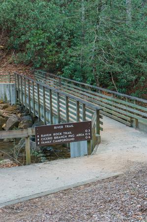
Starts at the Jacob Fork parking area and ends at the Cicero Branch parking area near the Family Campground. River Trail is an easy foot trail along Jacob Fork River. The Kid's Track Trail kiosk is located at the east end of River Trail with...
Provides access to the base of High Falls. An old road bed leading along the river fades into a narrower path before ending at the pool below the falls. Rocky in spots near the base of the falls.
River Loop trail is a double-lollipop shaped trail with two loops on each end: the north and south. The Black Mountain Campground sits near the middle.
### Southern (Upstream) Loop
The southern, or "upstream" loop, located southwest of the Black...
This is a loop with a short section of out-and-back trail up to the loop portion. Described here in a counter-clockwise direction for the loop portion.
Starting at the picnic area, ascends the steep river valley on a nice, newly-built path through a...
As its name implies, this trail follows the river (South Mills) and Bradley Creek, both of which you cross several times. Scenic. Expect to get wet up to your knees on this one. Impassible in high water.
Follows Roaring Fork Creek along FS 5520 and then up a short side path to the falls. This trail, being short and mostly easy, with just a few obstacles near the falls, is highly recommended!
Primarily used as a horse trail, but open to hikers. Follows gated logging roads with several vistas and stream crossings. Begins and ends on SR 1182. Follow the road to make a loop.
Climbs over Rock Knob, Paynes Knob, and another unnamed summit as it traverses the ridge at Shope Creek's eastern boundary. Very steep in places; cliff-top views in others. Nice sections of surviving Carolina Hemlock forest. Can be used to make a...
Starts at the Montreat campground next to Flat Creek and climbs the ridge west of Rocky Head (mountain) all the way to the summit. Passes the old water holding ponds (now dry) that were used for an electrical generation plant in the early 1900's. The...
Requires a long hike on the Old Mitchell Toll Road to reach the trailhead. Faint path at times. Ends on a rocky summit with spectacular views of the Asheville Watershed.
**Note**: this trail is not Montreat property, but has been purchased and...
This trail offers a walk through oak-hickory hardwood forests. The trail provides access from Hot Springs to the Rich Mountain Fire Tower. There is loop opportunity with the Appalachian Trail.
**Note**: a wildfire affected parts of this trail in...
This trail is one of the district's most difficult trails due to steepness in several places. It intersects the Appalachian and Groundhog trails to form a 9.5 mile loop.
The signed, blazed, and easy-to-follow trail is a loop, about a mile long, with no intersections. It leads to 60' Rufus Morgan Falls at its far end - a great destination. There are some steep and narrow spots, but overall it's a moderate trek. One...
A wide, newly-constructed, well-built trail that loops around on the ridges leading up to the boulder field below the south face of Rumbling Bald Mountain. The trail splits shorty beyond the parking area. Going clockwise: a nice view to the east...
Connects Turkey Ridge Trail to Raven Rock Trail. Closest access is .3 mi from the equestrian day-use parking area. The trail crosses the Jacob Fork River and ascends to Raven Rock Trail. This narrow trail is single track for horseback riders. One of...
Fantastic, high elevation trail. Starts at the Flat Laurel Creek trail and travels to the summit of Sam Knob. Blueberries abound in season. Short, high-elevation hardwood forest near the bottom, then heath balds and grassy areas near the top. At the...
This short trail starts at the Black Balsam parking area at the end of Black Balsam Road. It follows an old road bed through a mixed, high elevation forest on a level path to a big staircase that makes easy work out of the descent over a once highly...
Follows the steep gorge carved out by Little Slaty Creek. After crossing Upward Way, the trail continues upstream past the site of Montreat's old waterworks, crosses the stream on a bridge, then climbs to its terminus with the Julia Woodward trail,...
This trail may have been obliterated, and [sources say the Forest Service has no plans to re-establish it](http://www.hikinginthesmokys.com/linville_gorge.htm).
The Sassafras Creek Trail is an interior trail. It starts at a junction with the Big Snowbird Trail at a sharp left hand turn, then meanders for 1.0 mile to Sassafras Falls, a noted fishing spot. Beyond the falls, the trail continues for another 2.3...
Connects Upper CCC Trail to Horseridge Trail. Closest access is 2.5 mi from the Jacob Fork parking area. Sawtooth Trail crosses Little River at the top of a waterfall. The trail follows a ridgeline that climbs to a view south into the Jacob Fork...
The trail itself is a short climb up beside Setrock Creek through a hardwood & hemlock forest to the base of Setrock Creek Falls. Mostly easy, with a few rocks & roots to scurry over or around. There is a nice place to hang out and wade at...
This trail follows Shining Creek for the majority of its length. There are plenty of good spots to leave the trail and view undisturbed pools of green water or look upon steep slopes with plentiful, tall trees. The trail ends with multiple traverses...
Starts at the Shinny Creek Backcountry Campsite, which is 1.2 mi from the Jacob Fork parking area. Be prepared to cross the creek twice and navigate a log foot bridge. The foot trail ascends steeply to Upper Falls Trail. Shinny Creek and Shinny Creek...
FS 220, Shope Creek Road. Logging road with a gravel/natural surface climbs beside the main stem of Shope Creek through pine and hardwood forests. Reaches a logged area on the left, where the trail hooks into a clearing and ends. This area is filled...
Crosses the summit, which is exactly where you want to be when you visit Max Patch Mountain. Due to its central location, you can see just about everything from up here, from the Smokies, to Mount Mitchell, and halfway across Tennessee - which may be...
Connects the Wolfpit Road parking area at the edge of Linville Gorge Wilderness to the Mountains to Sea Trail about 2/3 of the way up Shortoff Mountain. Passes through an area that has been burned by wildfires repeatedly in the last 20 years, notably...
Starting from the Appalachian Trail junction at Garenflo Gap, this trail enters the woods and begins a steady downhill grade. Most of the way, the trail follows a creek on an old wooded road. In most places, the trail accommodates side-by-side...
The Shut-In Trail is a long, historic route which shares the path with the Mountains to Sea Trail. It travels from NC 191 near Bent Creek and Asheville to the Mount Pisgah parking area. George W. Vanderbilt, builder of the famous Biltmore Estate near...
Most of this trail was turned into a road during 2005. From Ledford Gap to Boyd Branch Road, it is a gravel road and will be permanently maintained that way. Not a trail. From Boyd Branch Road to Ingles Field Gap, it is currently an unimproved road...
This trail runs between from Cliffside Lake Road to a pull-off on US Hwy 64 about 0.4 mi west (north) of Dry Falls. The trail portion is 0.3 mi in length. Campers at the Van Hook Glade campground *could* combine the Van Hook trail (0.34 mi), with...
Starting at Exclamation Point, this newly re-opened trail travels on a path in the forest on Chimney Rock Mountain above the cliff band that forms Hickory Nut Gorge. While the new trail is situated at a much safer position on the mountain, it...
The Slickrock Creek Trail is the longest single trail in the Joyce Kilmer Slickrock Wilderness area. Starting at an elevation of 1160 feet at the Slickrock Trailhead and reaching 4860 feet at the Naked Ground termination, this trail has at least 12...
Provides access to the namesake waterfall after a very short distance on the trail. This segment is kid-friendly (it's very short). Continues uphill, past the falls, to the base of Looking Glass Rock; used mainly for climbing access. Stay away from...
Follows a small creek through young, mixed forests with plenty of the usual rhododendron and mountain laurel. Has recently been re-graded with some new bridges installed. Pleasant walk.
Mostly open "lollipop" loop with a few short climbs and descents, and a covered bridge. Longest trail in the Jackrabbit system. At the "tip" of the loop, you're only about 1/10 mile north of the GA state line.
Starting the Curtis Creek campground, the trail winds its way into the cove containing Slick Falls Branch on an old logging road, and then begins its signature climb. This is one steep trail! There are a few switchbacks, but they don't minimize the...
From the intersection of Stoney Fork Road and the Craggy Gardens Picnic Area access road in Beetree Gap, the Mountains to Sea Trail climbs past a nice clearing to a junction with the Snowball trail on the right. The Snowball trail slips off the north...
The Snowbird Mountain Trail is accessed from the Snowbird community area by following Snowbird Road, #1115 off Route 143, then taking Big Snowbird Road #1120 to the end at a trailhead called the “Junction”.
From the “Junction” trailhead,...
Short path leads to the observation deck above the falls. There are a few steps along the path. Be sure to stay away from the brink of the falls just off-trail to the left of the observation deck - that area is steep, muddy, and slippery.
This is a stream side trail along an old road bed for much of its length; pulls away from the river along one section around High Falls. Crosses the river using bridges (concrete and suspension bridges) and fords it many times as well. There are some...
The upper end of this trail, above FS 5097 (Neverending Road), was recently rerouted onto a much more reasonable grade with a few switchbacks, to replace the old, extremely steep and rocky drop down from Trace Ridge. It's now an easy climb or...
The Spirit Ridge Trail is a paved, ADA accessible trail located near mile marker 10 on the Cherohala Skyway. With easy parking, picnic tables and great views, this trail offers all visitors the opportunity to see the forest at an elevation of 3,700...
This trail offers a pleasant hike through a hardwood-pine forest and along a cascading mountain stream known for its trout fishing. Once part of the Brook's farm, an old house foundation, rock fences and a cemetary remain. Picnicking, restrooms,...
This is a long, backcountry trail. It's purpose-built trail that doesn't follow many logging roads - a rarity in Pisgah. From where this trail leaves the Bradley Creek Trail, it follows an easy grade to the old Mullinax homeplace where there is a...
Steep climb or descent mostly on eroded old roadbeds. Follows creek near the bottom; ascends to ridge near the top where it flattens out and passes through a clearing before ending on FS 74. Passes through a nice mature hardwood forest with a...
Short, narrow connector from Black Mountain trail to Thrift Cove/Grassy Road trails. A few steps, but mostly a narrow, leaf-covered trail that climbs gently. From Thrift Cove down to Sycamore Cove, the trail is open to bikes, a bit steeper, and...
Trailhead is located on Harmony Road and ends with the junction of the West Ridge Trail at the summit of Little Piney Mountain, also known as Stomping Knob. Starts with an easy rock-hop across a small brook that runs parallel to Little Piney Branch...
Ascends the southwest side of Stone Mountain, the highest point in DuPont State Forest at 3620 ft and a great place to catch a view of the forest 1000 ft below and to the south. Most of the trail follows an old road bed on a moderate grade up to a...
Starting at the Upper Trailhead parking lot, directly across from the campground road, this trail takes you across the summit of Stone Mountain and down again, past the park's Hutchinson Homestead, and then to 200-foot Stone Mountain Falls. Hikers...
The Stratton Bald Trail starts at the Rattler Ford Bridge on State Road 1127 near the Joyce Kilmer Memorial Forest, and gains more than 3,000 feet in elevation over Stratton Bald to its junction with the Stratton Bald Alternate Trail (TR54A). From...
Starts with a beautiful climb up Ferguson Peak from Hickorynut Gap on US Hwy 74-A, then proceeds through Strawberry Gap and up to Blue Ridge Pastures. Passes through a series of switchbacks on a newly-built, well-constructed trail with steps and...
Extremely poorly designed at NC 215 (east) end. Extremely steep. Rest of trail generally follows old roadbeds; very wet & muddy in places. Frequently used to access Courthouse Falls trail on west end, this section of trail is nice and travels...
This easy leg stretcher leads from the summit parking area to the circular observation platform at the summit itself.
This is a paved path through a Fraser fir forest that was wiped out in the 1980's. All the mature firs died, but new ones sprouted...
Climbs from the parking area to the summit, thru switchbacks as it goes. Crosses over an old road (which used to be the main route to the summit) several times on the way. Travels through a northern hardwood forest, which is open and attractive; near...
Passes through the picnic area as it winds up to the 4,665 foot summit through a red oak forest, with an understory of mountain laurel and rhododendron. Good view near the summit; however, it's developed with towers, signs, etc. Continue to Luther...
A short path which leads up the steps from the upper parking area, through an area of short spruce and fir trees, across the Mile High Swinging Bridge, and then over to the rocky viewpoints on Linville Peak. An easy walk, but there are some steps and...
Travels up & down through coves near small streams; cove hardwood forests. In between, travels sidehill near the top of the ridge w/ a mixed hardwood forest.
A nice stroll through the woods, but don't expect a view like the name might suggest. There's not really any rock visible on the small mountain known as Table Rock, and it is tree-covered.
Rocky climb along the side of the eponymous mountain to its summit. Passes by a lot of neat rock features. There are fantastic views from the summit. Very popular; makes up the Table Rock Best Hike. Passes through varying forests and open areas...
This excellent trail, completed in 1993, follows the contours of Grandfather Mountain above the Blue Ridge Parkway. It travels through interesting and diverse geology and forest environments, including northern hardwood forests and spruce-fir...
Follows the upper reaches of Shope Creek inside a small gulch cut by the stream, above Forrest Falls. Steep in places. Crosses the creek and tributaries in a few places. The creek is small and slows to a trickle at times up here. Beautiful...
This easy trail travels up "the lump", a cleared hillside located beside the Parkway. This hill is great for flying kites and/or model airplanes, which you will often see people doing.
Climbs steeply from FS 1206 to the Pilot Rock trail near the summit of Little Bald Mountain. Starts in a cove with one significant creek crossing, through young cove forest. Winds up passing through several switchbacks into an older, yet shorter,...
Starts at the back of the Mortimer Campground and loops back. Passes Thorps Creek Falls - a small 15' cascade and slide into a nice pool - near the bottom. Follows the same path as Schoolhouse Ridge for a short distance and in recent years, has been...
From Lake Dense, the trail follows an old road bed past the picnic shelter, across the dam, and over to Lake Alford. It has moderate grades, and goes through a pine/hemlock forest where many of the hemlocks are dying. There is a great view of Joanna...
The upper portion above the Trace Ridge trailhead follows an old roadbed up the ridge all the way to the Blue Ridge Parkway. Rocky; steep. Very eroded in places. Dry pine-oak forests can be found along the nondescript ridge.
Downhill from the...
Travels from the Hooker Falls parking area up to Triple Falls. Near the parking area the trail is level with a few rocks and wet places; near the falls it climbs very steeply but the surface is mostly smooth.
This newly designated trail follows segments of newly constructed path as well as some sections of old logging roads over an easement on private property. Starting at Bearwallow Gap, the trail descends on a new singletrack path through a series of...
This old road is reverting back to a singletrack trail. The new extension from Pinnacle Mountain Road down to Briery Fork trail (a true trail, built early 2013) opens up many more loop hiking options in the south portion of DuPont SF, including a...
Long ridgeline trail which undulates up and down over the various knobs on its summit. Very steep in places; has some issues with erosion as well. It winds onto the edge of private land in places; stay on the trail. Travels through a typical...
Starts at the equestrian parking lot. Main artery for the equestrian trails. The trail provides access to Saddleback Trail. Turkey Ridge Trail crosses the park road and ascends to Little River Trail. Horses and hikers share this trail.
Connects Little River Trail to Horseridge Trail. Closest access is 2.1 mi from the Jacob Fork parking area. The Upper CCC Trail was named for the Camp Dyer CCC. The trail has views north into the Little River Watershed. Horses and hikers share this...
Starting at FS 74, climbs moderately on a wide old road bed through a couple of switchbacks, first to the right and then to the left. Be sure not to take any mis-leading side trails leading away from the switchbacks on the old road. Traverses the...
Loop trail; from the parking lot going clockwise, it switchbacks down to the creek just above the top of the falls and crosses. Be careful here; it will be impossible during high water. The trail then descends alongside the falls with a few views of...
Connects Raven Rock Trail to Lower CCC Trail. Closest access is 1.1 mi from the Jacob Fork parking area. The trail divides the park north and south. It crosses the Jacob Fork River above High Shoals Falls. Be prepared for a stream crossing. The trail...
Small obstacles such as rock crossings and tighter turns. Comes close to the ridgetop where deer like to forage. You'll hear other hikers and riders on the Central Loop, which is not far down the slope from you at most times.
This trail offers a walk along streams and ridge tops where remains of old homesteads and fields are evident. The vegetation changes from low, dense vegetation along the stream to cove hardwoods and piney ridge tops. Picnicking, water, restrooms and...
Climbs from the Mills River up to Wagon Road Gap on the Turkey Pen Gap trail through a pleasant cove forest. It enables the only (day hike) loop from the Turkeypen trailhead parking using the Turkey Pen Gap trail.
The bottom-most portion passes...
Ascends steeply on the ridge above the creek to FS 74. Travels through scenic mixed hardwood forests. The upper section is extremely rocky, and the rocks are slick when wet.
Short path near the summit of the ridge to the summit of Walker's Knob with a fantastic view south and west of Montreat, Black Mountain and the Swannanoa Valley. Has a few rocks and roots, and a small climb at the end, but it is overall very easy....
The Walton Interpretive Trail is named for Walton Smith, a resident in Cowee NC who led the charge against clearcut logging thorough the Western North Carolina Alliance's Forest Management Task Force from the late 70's through the early 90's. The...
Easy at first as it climbs along a tributary of Shope Creek, then steepens near the end as it climbs to a gap below Rock Knob. Follows and old logging road. Several other old road beds go off from this one, but this is the most well-worn path....
Short connector from Hendersonville Reservoir Road, FS 142, to the Trace Ridge trail on an old road bed. Crosses a small seep and passes into a recently logged area near the junction.
This path starts out paved and travels to overlooks which include views to the Great Smoky Mountains National Park, and south into the southern mountains and the Piedmont region. The trail becomes dirt past an overlook before it reaches the summit...
Traverses the summit of the Seven Sisters ridge from Stomping Knob to the summit of Big Slaty Mountain (False Graybeard), not far from the summit of Graybeard. Somewhat rough and steep in places. No views to speak of except through the trees in the...
This trail offers a walk through upland hardwood forests with winter views of Baxter Cliffs. The trail provides loop opportunities with the Hickey Fork trail.
A National Recreation Trail, this loop climbs an old roadbed and travels along the brink of some of the East's most spectacular cliffs. Named for these cliffs, the mountains side does look "white" from a distance with sun shining on the light gray...
This paved path leads 1/4 mile through a nice forest to the upper overlook for Whitewater Falls. An optional set of 154 wooden steps leads to a lower overlook with a slightly different view. Excellent wheelchair-accessible trail is also great for...
From the backpack parking area, the trail reaches Window's Creek a few yards a few yards upstream of Widow's Creek Falls, one of the prettiest in the park. (To reach the falls, take the trail at the parking spot just northeast of this trailhead). It...
**Note**: [The trail is now officially open](https://conservingcarolina.org/new-trail-connects-bearwallow-to-wildcat-rock/) all the way to [Bearwallow Mountain](/trailheads/bearwallow-mountain/)! GPS recordings and our GIS data show the hike to be...
Starting just west of Salt Rock along the Panthertown Valley trail, this trail descends on a path with three distinct characters, past the base of Wilderness Falls. The upper portion is not recommended until a re-route of the middle section is...
The Windy Gap Trail starts at the Big Fat Gap Trailhead, reached by a nine mile drive on the FS 62 Big Fat Gap Road, accessed from US Route 129 north of the Robbinsville area. This road is gated, and closed to the public from January 1 through April...
Easy walk on old road from Tarklin Br. Rd. to Sandy Tr. Narrows a bit, then narrows a lot and gets rougher - with some climbs up over some rocks - right before reaching the base of the falls.
Moderate uphill hike along Wolf Branch through a couple of logged areas. Continue uphill on Wolf Branch past the last clearing to reach "Casita Falls". Unofficial names.
Travels through the relatively flat stream bottom at the base of the mountains. Near the western end of this trail, you can see the hills rising out of the valley, and you'll start climb them before you reach Ledford Branch Road. Lots of ground pine,...
Climbs from Wolfden Flats trail up to a dead-end not far below Wolfden Falls, which only flow during wet weather. The falls is located high up on a tributary draining Wolfden Knob. You may be able to see and hear the falls from the end of the road...
Climbs from Forrest Falls toward the upper reaches of Shope Creek along old logging roads. Enters a nearly flat area below Wolfden Knob at its upper end, which is wet with several tributaries. Identified as roads "I" and "J" on the Shope Creek...
The Wolf Laurel Trail leads from the Wolf Laurel trailhead to the Stratton Bald Trail. The Wolf Laurel Trailhead is located off Forest Service Road #81, seasonally closed from January 1-March 31. FS #81 is accessed off the Joyce Kilmer Road near its...
This trail is accessible via the Stone Mountain Loop Trail or the Cedar Rock Trail and provides
views of the Blue Ridge Mountain escarpment. The ridges dividing three watersheds (Garden Creek, Widow's Creek and Bullhead Creek) can also be seen from...
From the Harper Creek trail: follows an old logging road, moderately at first and then steeply. It passes over the unassuming peak of Yellow Buck Mountain, through a pine and oak forest, before following Long Ridge to the junctions with Persimmon...
The Yellow Hammer Gap Trail is an interior trail, connecting with the Nichols Cove and Ike Branch Trails. The Benton MacKaye Trail follows its entire length. Starting at Nichols Cove in the Joyce Kilmer Slickrock Wilderness, this trail heads...
Formerly known as Kitsuma or Kitsuma Peak trail. Starting at the top near Ridgecrest, the trail heads straight out of the back of the parking lot and ascends gently beside I-40. It swings left and climbs more steeply through a set of 12 switchbacks...


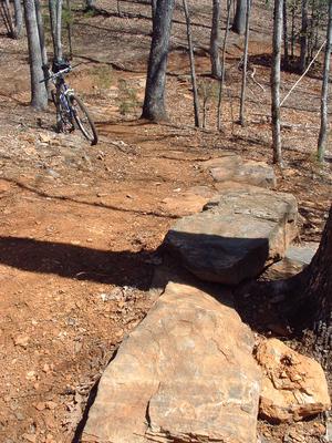


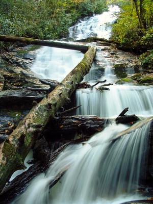

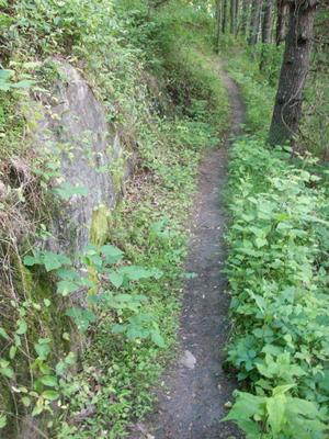
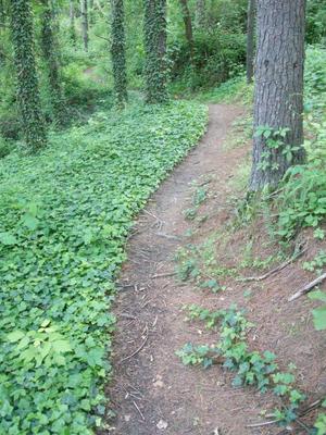

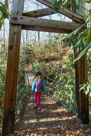
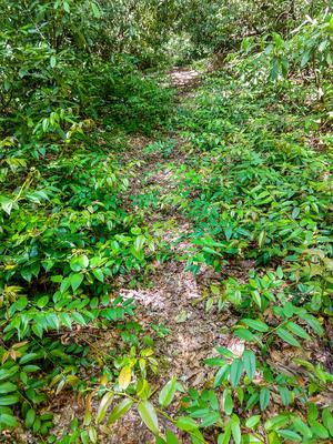
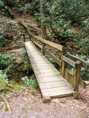
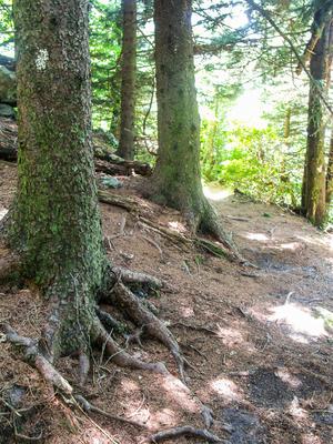
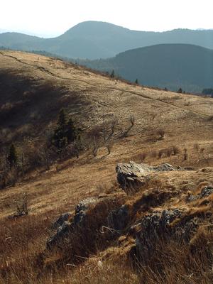
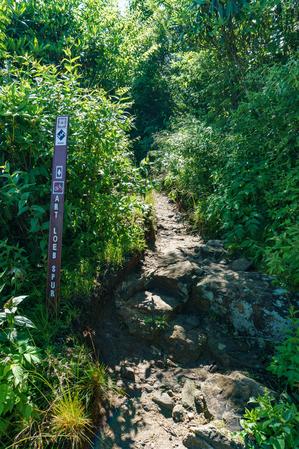
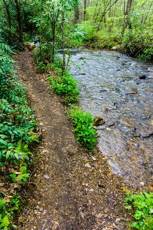
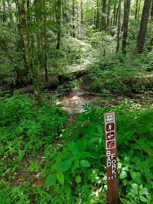
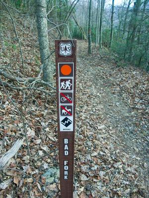
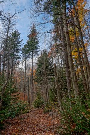
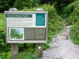
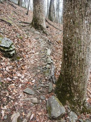
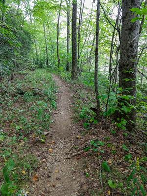
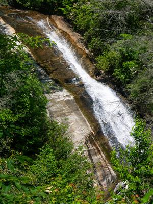
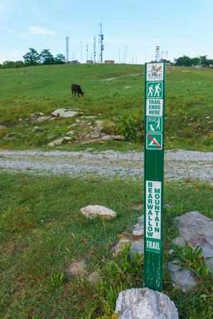
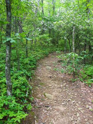
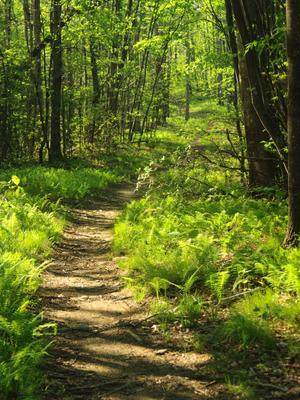
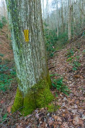
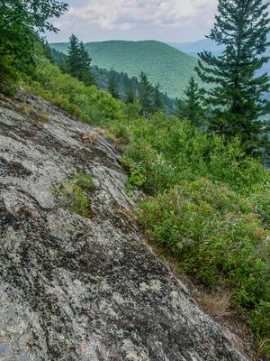
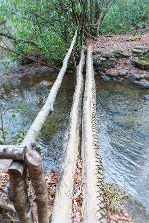


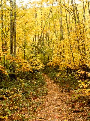
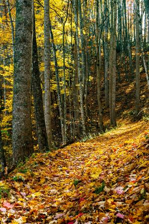
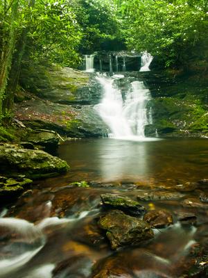
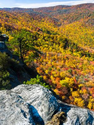
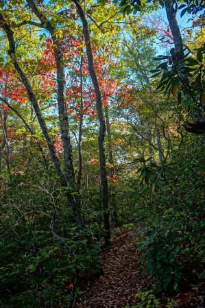
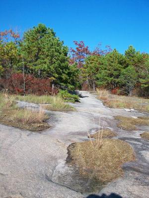
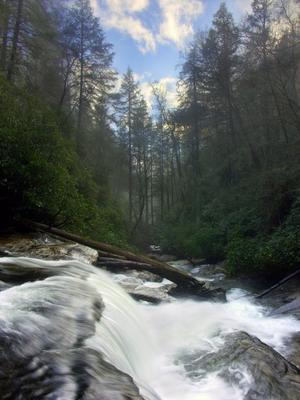
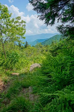
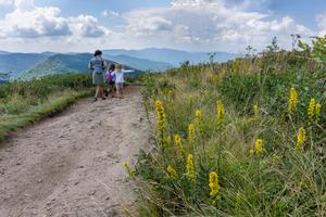
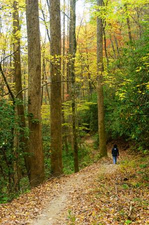
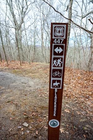
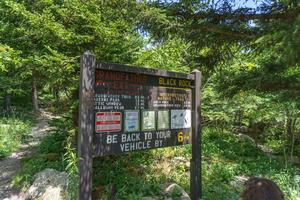
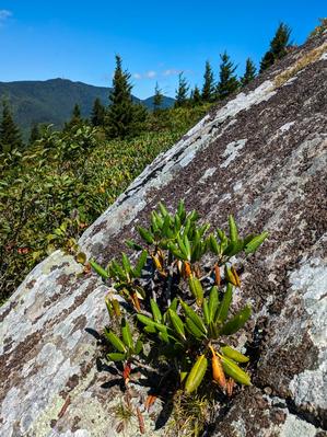
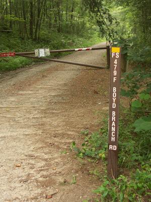
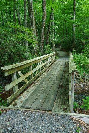
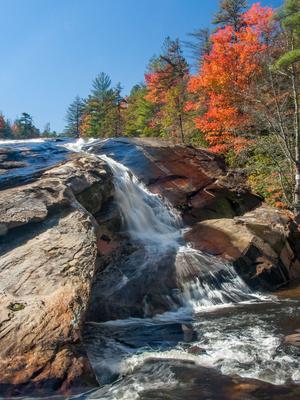
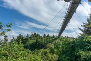
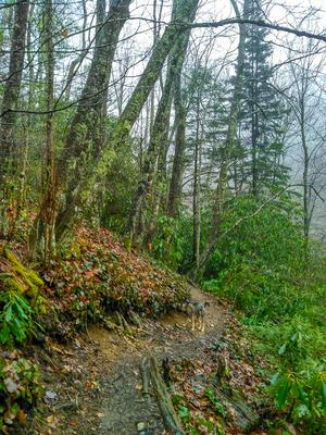
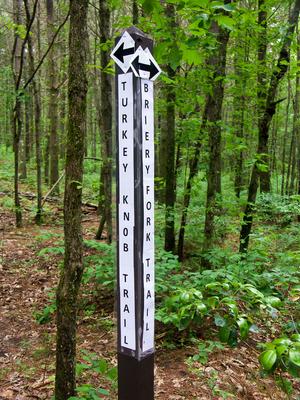
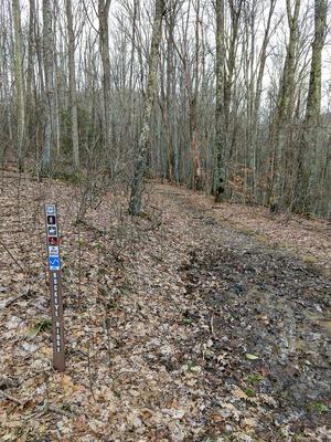

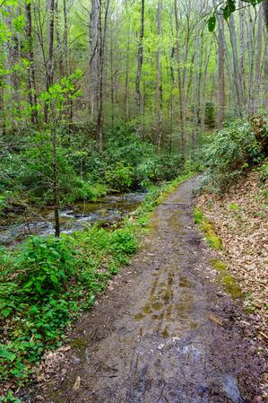
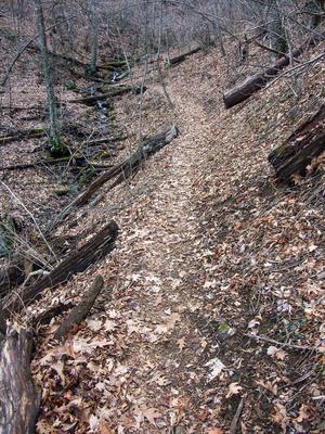
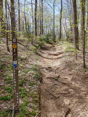
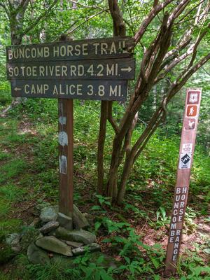
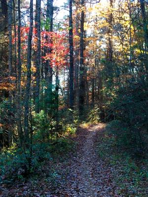
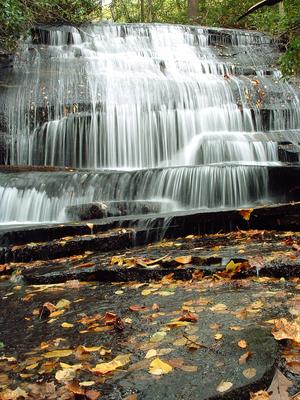
")