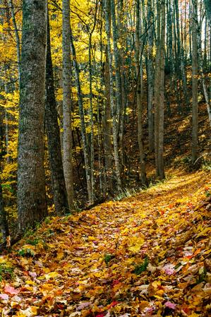
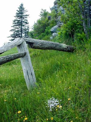
Trails in the Great Smoky Mountains National Park Trailhead Area

Here is a list of all trails in the Great Smoky Mountains National Park Trailhead area.
Each trail has its own printable page with all the information and links, including (where available):
- directions to the starting point
- difficulty
- length
- elevation change
- a map
- photos from along the way, and
- a detailed description and trail directions.
For general information about the Great Smoky Mountains National Park trailhead, see the Great Smoky Mountains National Park Trailhead page.
Need to find trails by another method? Go back to Trails.

Abrams Falls Trail


Ace Gap Trail
Albright Grove Trail

Alum Cave Trail

Anthony Creek Trail
Appalachian Trail - Charlie's Bunion to Peck's Corner

Appalachian Trail - Clingman's Dome to Silers Bald
Appalachian Trail - Doe Knob to Fontana Dam
Appalachian Trail - Eagle Creek to Doe Knob
Appalachian Trail - Low Gap to Davenport Gap
Appalachian Trail - Miry Ridge to Eagle Creek
Appalachian Trail - Newfound Gap to C.Bunion
Appalachian Trail - Newfound Gap to Charlie's Bunion
Appalachian Trail - Peck's Corner to Tricorner Knob
Appalachian Trail - Silers Bald Shelter to Jct M R
Appalachian Trail - Tricorner Knob to Low Gap
Balsam Mountain Trail
Baskins Creek Trail
Baxter Creek Trail
Bear Creek Trail
Beard Cane Trail
Beech Gap I Trail
Beech Gap II Trail
Big Creek Trail
Big Fork Ridge Trail
Bone Valley Trail
Boogerman Trail
Bote Mountain Trail
Bradley Fork Trail
Brushy Mountain Trail
Bullhead Trail
Cabin Flats Trail
Caldwell Fork Trail
Camel Gap Trail
Cane Creek Trail
Cataloochee Divide Trail
Chasteen Creek Trail
Chestnut Branch Trail
Chestnut Top Trail
Chimney Tops Trail
Clingmans Dome Bypass Trail
Cold Springs Gap Trail
Cooper Creek Trail
Cooper Road Trail
Cove Mountain Trail
Crib Gap Trail
Crooked Arm Ridge Trail
Cucumber Gap Trail
Curry Mountain Trail
Deep Creek Trail
Deeplow Gap Trail
Dry Sluice Gap Trail
Eagle Creek Trail
Enloe Creek Trail
Finley Cane Trail
Flat Creek Trail
Fork Ridge Trail
Forney Creek Trail
Forney Ridge Trail
Gabes Mountain Trail
Gatlinburg Trail
Goldmine Loop Trail
Gold Mine Trail
Goshen Prong Trail
Grapeyard Ridge Trail
Grassy Branch Trail
Greenbrier Ridge Trail
Gregory Bald Trail
Gregory Ridge Trail
Gunter Fork Trail
Hannah Mountain Trail
Hatcher Mountain Trail
Hazel Creek Trail
Hemphill Bald Trail
Hughes Ridge Trail
Huskey Gap Trail
Hyatt Ridge Trail
Indian Creek Motor Trail
Indian Creek Trail
Indian Grave Gap Trail
Jakes Creek Trail
Jenkins Ridge Trail
Jonas Creek Trail
Juney Whank Falls Trail
Kanati Fork Trail
Kephart Prong Trail
Lakeshore Trail - #77 to Campsite #81
Lakeshore Trail - #81 To Campsite #86
Lakeshore Trail - Hazel Creek To Campsite 90
Lakeshore Trail - Lakeview Dr. To #77
Laurel Falls Trail
Lead Cove Trail
Little Bottoms Trail
Little Brier Gap Trail
Little Cataloochee Trail
Little Greenbrier Trail
Little River Trail
Long Bunk Trail
Long Hungry Ridge Trail
Loop Trail
Lost Cove Trail
Lower Mt. Cammerer Trail
Low Gap Trail I
Low Gap Trail II
LT - #90 To Fontana Dam Trail
Lumber Ridge Trail
Lynn Camp Prong Trail
Maddron Bald Trail
Martins Gap Trail
McKee Branch Trail
Meigs Creek Trail
Meigs Mountain Trail
Metcalf Bottoms Trail
Middle Prong Trail
Mingus Creek Trail
Miry Ridge Trail
Mountains to Sea Section 1 Trail
Mount Cammerer Trail
Mount Sterling Ridge Trail
Mount Sterling Trail
Newton Bald Trail
Noland Creek Trail
Noland Divide Trail
Oconaluftee River Trail
Old Settlers Trail
Old Sugarlands Trail
Palmer Creek Trail
Panther Creek Trail
Pole Road Creek Trail
Polls Gap Trail
Porters Creek Trail
Pretty Hollow Gap Trail
Rabbit Creek Trail
Rainbow Falls Trail
Ramsay Cascades Trail
Rich Mountain Loop Trail
Rich Mountain Trail
Road Prong Trail
Rough Creek Trail
Rough Fork Trail
Roundtop Trail
Russell Field Trail
Schoolhouse Gap Trail
Scott Mountain Trail
Smokemont Loop Trail
Snake Den Ridge Trail
Springhouse Branch Trail
Spruce Mountain Trail
Stone Pile Gap Trail
Sugarland Mountain Trail
Sunkota Ridge Trail
Swallow Fork Trail
Sweat Heifer Creek Trail
The Boulevard Trail
Thomas Divide Trail
Trillium Gap Trail
Tunnel Bypass Trail
Turkeypen Ridge Trail
Twentymile Loop Trail
Twentymile Trail
Twin Creeks Trail
Welch Ridge Trail
West Prong Trail
Wet Bottom Trail
Whiteoak Branch Trail
Wolf Ridge Trail
