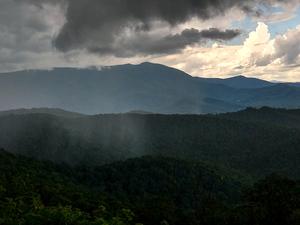
Western North Carolina Weather and Climate Information
Asheville, NC, WNC's largest city, has a mild climate year-round. At an elevation just over 2000 ft, the climate in Asheville is definitely different from surrounding Southeastern cities. Several towns in Western NC are considerably higher than Asheville - up to 5500 ft at Beech Mountain - so keep this in mind as elevation is one of the prime factors affecting weather.
Look here for a good climate summary of Asheville, and compare with nearby Beech Mountain at 5,506 ft elevation to the north and Greenville, SC at 984 ft to Asheville's south to see examples of the wide range of climates experienced across the Southern Appalachians.

Current Conditions
Map widget by Windy.com
In addition to the forecast from the National Weather Service, here are some links to other resources I use frequently when planning my outings:
- Ray's Weather is an excellent local, real-time weather resource for data as well as detailed forecasts and weather discussions.
- ResortCams.com has live streaming cams from around the mountains, for a real-time look at current conditions. Views include ski resorts, mountains, and the quaint downtowns of several area municipalities. Excellent for checking road conditions as well.
The Mountains have some of the most wildly varying weather in the Southeast. Consider average rainfall in two towns - Highlands and Marshall - separated by a two hours' drive. Highlands sits at the edge of the Southern escarpment, so most air lifted over the mountains drops heavy amounts of rain on this high-elevation town. In fact, nearby areas are wet enough to be considered rain forests, and waterfalls abound. The town of Marshall, however, sits at the north end of the French Broad River basin. Shielded from the prevailing moist winds from the South and West by the Balsam and Smoky Mountains (where most of the rainfall is squeezed out), this area is the driest in the entire state of North Carolina!
Below is a roundup of typical climactic conditions in and around the Asheville area. Areas above and North of Asheville are generally cooler and wetter, while areas south and lower than Asheville are generally warmer and also wetter (yes! Asheville sits in a dry slot along the French Broad River Valley, and areas all around it, except just North, are wetter).
Spring:
This season can bring wildly varying weather--anything from snow, to heat waves in the 90's, but it's usually mild and fairly wet. It's also very scenic as the new leaves and wildflowers advance higher and higher in elevation.
Summer:
Temperatures in the mountain valleys are typically in the mid 80's, only occasionally reaching 90 or above, and scattered afternoon thunderstorms are likely. The cool forests, cold streams, and high mountain elevations offer respite from the heat on rare occasions when it gets too hot to hike in the valleys. This is a wet season, and when cold fronts do move through, widespread heavy rain can occur, and influence from tropical systems - heavy rain and wind - is possible mainly toward late summer. Beware of nagging insects during summer.
Fall:
This season offers spectacular leaf displays, cooler temperatures (60's and 70's), clear, dry, crisp air, and great weather for hiking. This is, on average, the driest season. Early fall brings the possibility of tropical systems with rain and wind. The best fall colors
are from late September on the highest peaks to late October or early November in the valleys.
Winter:
You will experience occasional snow during this wet season, with average highs in the 40's and 50's; however extreme cold and snow is not at all uncommon, as are days that are sunny and 60 degrees. The snow generally melts quickly, though it may stay around for a month or
more at higher elevations. Trails may be icy and high-elevation wet trails may require crampons or avoidance due to large slabs of ice.
Of course, these are only general summaries, and the weather doesn't always fall into neat little generals. Check out this description for an example:
"May 2, 1999. I am on the Black Mountain trail. The trees in the valley are in full leaf. Here on the ridgeline they are bare, but the buds are swelling and wildflowers are out everywhere. Although we've only climbed to 4000' elevation and it is 75 degrees, we are starting to see patches of snow in the woods! Snow is even covering parts of the trail. With 2500' of elevation between us and the highest mountains, which are completely white-capped, I am convinced that snow is possible in these majestic heights at any time of the year.
Remember that the weather can change quickly. Severe summer thunderstorms can form in an hour or less on days that start clear. The weather at high elevations is much more severe - it's 10-15 or more degrees colder (temperatures above 6000 feet rarely exceed 75 degrees), much windier, and always wetter than the valleys below. As much as 5 feet of snow have been recorded in the high elevations in the late spring during one storm, and temperatures can be in the 30's at night then. Be prepared for whatever weather is possible during the entirety of your trip. Stay away from high, exposed areas or mountaintops during thunderstorms. Dress in layers for warmth, and wear proper, appropriate clothing (of course). Check the weather before each trip. I have a link to a good Asheville area forecast on my home page.


