Ascends moderately through mixed hardwoods and then runs slightly downhill along the crest of the ridge on an old logging road. It descends steeply for a brief stretch into the flats right above the cliffs, in an open oak forest. There are a couple...
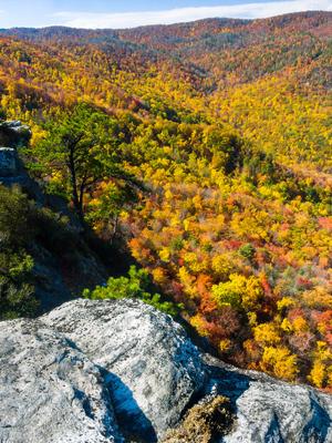
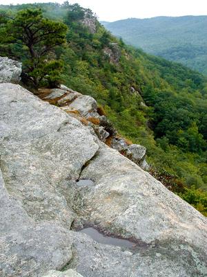
A mostly moderate hike through pleasant woods, but with some steeper sections. Like nearby Little and Big Lost Cove Cliffs trails, the trail ends at an outcropping with outstanding views across Lost Cove and Timber Ridge, and up to Grandfather...
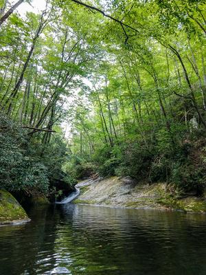
Although this trail is listed as "easy" in some publications, that's not really the case. It might be considered moderate if you only hike to the falls and back, but the whole trail is much longer than that. And the multiple creek crossings, sparse...
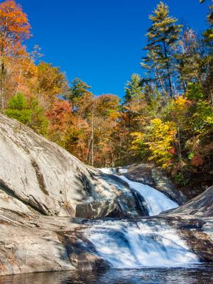
This trail is a co-signed as a portion of the Mountains to Sea Trail and takes you to a popular, yet small, waterfall on Lost Cove Creek.
From the well signed trailhead on FR 464, the trail descends moderately through a few switchbacks and then...
A nice trail leads to the eponymous rock outcrop from which unfolds a spectacular view of the Blue Ridge Mountains, with Grandfather Mountain framing the horizon. Most of the trail follows old road or skid road beds; it is moderately rocky in places...
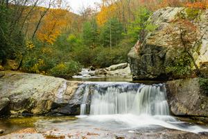
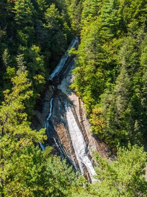
Climbs from the Harper Creek Trail above Harper Creek Falls, past Bard Falls and North Harper Creek Falls, ending on Kawana Road. Several creek crossings and a wilderness setting add to the difficulty of this trail, which would otherwise be rated as...
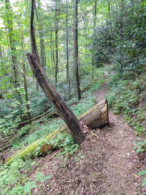
75% of this trail is in great shape; travels along an old roadbed through beautiful woods with few obstacles. Judging by the size of the trees growing on the roadbed, it's been here a while. The last little bit turns into a true foot path and is a...
This trail is co-signed as the Mountains to Sea Trail. It's a shortcut from FS 464, Pineola Road, down to a beautiful section of the North Harper Creek trail about a half mile above Bard Falls. This trail is the easiest way to the falls, but it's a...
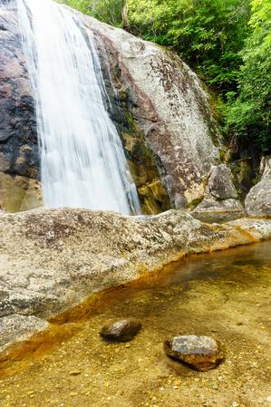
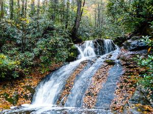
Trail begins on SR 1327 and intersects with trail 255. It's a 10-15 minute hike to a 40 ft high sliding waterfall on the stream that share's the trail's name, but it's a difficult scramble down a bank to the best view. A smaller waterfall is upstream...
A 4 mile trail that begins at the Wilson Creek Visitor Center and winds its way over to a junction with Raider Camp trail, touching Pine Ridge Connector and Phillips Branch along the way. This makes for several longer loop options in the vicinity.
Connects the Pine Ridge Trail to FS 198, Chestnut Mountain Road. Using this road, creates loop opportunities by combining the Mountains to Sea, Raider Camp, and Pine Ridge trails, or longer loops using others.
Follows an old road bed up Raider Camp Creek from the campsite below Harper Creek Falls. Deeply eroded in places. Bypasses a section of the old road on a singletrack trail.
Formerly, this trail ended near the Kawana settlement above South Harper...
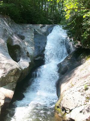
Starts at the back of the Mortimer Campground and loops back. Passes Thorps Creek Falls - a small 15' cascade and slide into a nice pool - near the bottom. Follows the same path as Schoolhouse Ridge for a short distance and in recent years, has been...
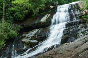
Loop trail; from the parking lot going clockwise, it switchbacks down to the creek just above the top of the falls and crosses. Be careful here; it will be impossible during high water. The trail then descends alongside the falls with a few views of...
From the Harper Creek trail: follows an old logging road, moderately at first and then steeply. It passes over the unassuming peak of Yellow Buck Mountain, through a pine and oak forest, before following Long Ridge to the junctions with Persimmon...
2.1mi, Climbs Steeply, Very Rough
Nearby Trails
The following trails cross into this trailhead area, but are primarily accessed from another trailhead:
**Black Mountain Campground to Beacon Heights**
From Black Mounain Recreation Area by South Toe River in Pisgah NF to Buck Gap at BRP mp 344.1: Climbs the ridge. From Buck Gap at BRP mp 344.1 (NC-80) to Woodlawn Park (US-221): The MST leaves the...