Starting on the west rim of Linville Gorge at the parking area on Kistler Memorial Highway, the trail descends the gorge steeply all the way down to the Linville River 1700 vertical ft below. It passes first through some mid-elevation forested areas...
This trail may have been obliterated, and [sources say the Forest Service has no plans to re-establish it](http://www.hikinginthesmokys.com/linville_gorge.htm).
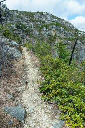
Connects the Wolfpit Road parking area at the edge of Linville Gorge Wilderness to the Mountains to Sea Trail about 2/3 of the way up Shortoff Mountain. Passes through an area that has been burned by wildfires repeatedly in the last 20 years, notably...
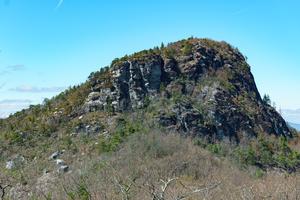
Rocky climb along the side of the eponymous mountain to its summit. Passes by a lot of neat rock features. There are fantastic views from the summit. Very popular; makes up the Table Rock Best Hike. Passes through varying forests and open areas...
1.4mi, Climbs Steeply, Moderately Rough
Nearby Trails
The following trails cross into this trailhead area, but are primarily accessed from another trailhead:
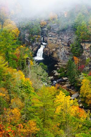
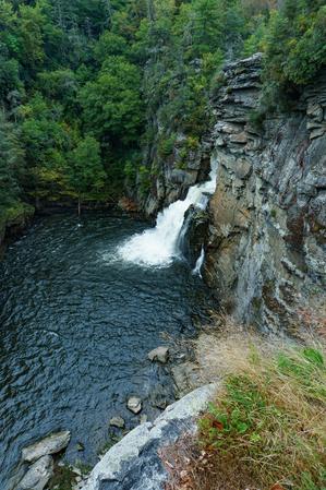
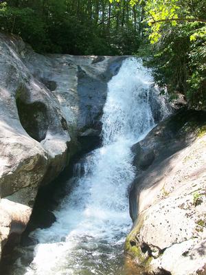
This trail travels to four excellent views of the Upper and Lower Falls. The first overlook takes you to the pool at Upper Falls. From this vantage point you can see the river pouring into the narrorw gorge above the lower falls. The second...
From the visitor center, this trail starts out fairly smooth through a forest of very large hemlocks and white pines to the junction with the Plunge Basin overlook split. The trail to the overlook is downhill and has some obstacles, but is well...
**Black Mountain Campground to Beacon Heights**
From Black Mounain Recreation Area by South Toe River in Pisgah NF to Buck Gap at BRP mp 344.1: Climbs the ridge. From Buck Gap at BRP mp 344.1 (NC-80) to Woodlawn Park (US-221): The MST leaves the...